Whiskers Point campground
A forested campground on a peninsula in McLeod Lake, with a short beach-and-woods nature loop. It makes a practical Highway 97 camping stop or a brief daytime walk.
Sources reviewed . This is a research date, not a trail inspection.
The locations GPX contains sourced points with their recorded roles. It contains no trail track or connecting route.
Site map
A reusable trail line has not yet been verified for this outing. Any location pin shows the published location described above; it does not draw the hike or establish a navigable approach.
Getting there & parking
Follow Highway 97 north from Prince George for approximately 130 km to Whiskers Point Park.
Full access notes
Take the signed Whiskers Point Park turn from Highway 97, approximately 130 km north of Prince George. Follow the internal signs for camping or day use rather than parking in a campsite to reach the beach. Check current reservations, operating season and service notices with BC Parks before planning an overnight stay.
park/campground. Source-published approximate distance from Prince George; not a current routed travel time.
130 km from town in the source description. park/campground. Source-published approximate distance from Prince George; not a current routed travel time.
Map position: 54.90631, -122.93561 · official park map reference; campground entrance unverified. BC Parks detailed-map link explicitly publishes center=-122.935609,54.906311. Marker locates the associated park as chosen by BC Parks, not an individual campsite or verified campground entrance. Do not calculate trailhead driving distance from this point.
At the campsite
For a short outing from camp, follow the nature path beside the beach and through the woods back to the campground. BC Parks describes this as about a 20-minute loop.
Full route notes
From the campground area, follow the nature path toward the beach and continue through the forest to complete the short loop back. BC Parks describes the walk as taking about 20 minutes; it is separate from the lakeside camping roads and any longer regional hike. The surrounding forest and lake offer wildlife-viewing opportunities, but remain on established paths and avoid disturbing animals at the shore. A municipal guide prints an implausible 444 m gain for a short park nature trail, so that number should not be used to rate this walk. Return to the correct campground or day-use access.
Conditions & seasons
Season-specific access has not been established in this guide. Read the dated notices and original land-manager information before choosing a departure date.
Winter route
The official winter advisory says vehicle access is unavailable and pedestrian access may lack parking.
These are dated research notes. Open the trip planner for current available weather and advisory feeds; no alert found does not establish that a trail or road is open.
Camping & overnight plans
Established BC Parks camping on McLeod Lake. Use the current official booking and advisory information for fees, operating dates and campsite services.
Photos of Whiskers Point campground
A photograph with confirmed reuse permission has not yet been added to this guide.
Surrounding area and context
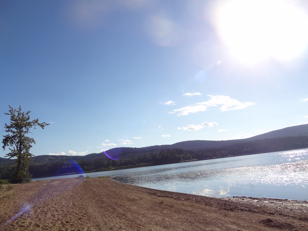
These photographs provide context; they do not establish the appearance of this selected route or facility.
Take this guide with you
Choose a trip pack or an available individual sheet for your map case.
Sources, dates & research notes
Descriptions are written for this guide from the linked evidence. Source review dates, published reports and field observations can differ. Photographs and route lines retain their own attribution and reuse terms.
- https://bcparks.ca/whiskers-point-park/ (opens original source)
- https://governmentofbc.maps.arcgis.com/apps/instant/basic/index.html?appid=4b3eb47c25ff45fa9f6bff45e3f2a389¢er=-122.935609,54.906311&level=11 (opens original source)
- https://districtofmackenzie.ca/wp-content/uploads/2025/06/DOM-2025TourismGuide-Final-Web2.pdf (opens original source)
Details still being researched
- No site-specific dog rule verified in reviewed sources.
Nearby and related guides
- Waterfalls · Bear Lake & northern lakes
War Falls
A short walk in Carp Lake Park reaches two distinct cascades on the McLeod River. The falls are close to War Lake camping, but the viewpoint is a day-walk destination rather than…
Moderate / 1.6 km · one way onlyRead guide → - Camping · Bear Lake & northern lakes
War Lake campground
A smaller camping base within Carp Lake Park near the War Falls walk. It is reached on the same resource-road approach as the main lake campground but is a separate camping area.
Camping destination · access & overnight informationRead guide → - Camping · Bear Lake & northern lakes
Carp Lake campground
A remote frontcountry base for lake recreation and short interpretive walks. Supplies are back at McLeod Lake, so arrive prepared rather than expecting a resort or village at the…
Camping destination · access & overnight informationRead guide → - Hikes · Bear Lake & northern lakes
Carp Lake–Rainbow Lake–McLeod River interpretive loop
A short interpretive loop links Carp Lake campground with Rainbow Lake and the McLeod River. It offers a land-based outing among the park’s better-known boating and fishing…
3 km loopRead guide → - Camping · Bear Lake & northern lakes
Carp Lake island camps
Three island camping areas provide a more secluded Carp Lake overnight reached by boat or canoe. They require water-travel planning and self-sufficiency rather than a walking…
Camping destination · access & overnight informationRead guide → - Camping · Bear Lake & northern lakes
Tacheeda Lakes Point
The Point camping area at Tacheeda Lakes provides rustic lake access north of Prince George. It is a separate site within the lake area, reached through a resource-road network…
Camping destination · access & overnight informationRead guide →