Canyon Creek Campground and RV Park
Canyon Creek is a private campground in Hixon beside Canyon Creek and Hixon Creek. It offers tenting and RV stays as a base for short outings in the Highway 97 corridor. The operator’s park map identifies campsite types, facilities and internal trails; campsite availability and the campground’s walking paths are separate from public access to nearby Hixon Falls.
Sources reviewed . This is a research date, not a trail inspection.
The locations GPX contains sourced points with their recorded roles. It contains no trail track or connecting route.
Site map
A reusable trail line has not yet been verified for this outing. Any location pin shows the published location described above; it does not draw the hike or establish a navigable approach.
Getting there & parking
Use the operator’s address, 39035 Highway 97 South, Hixon, to reach the campground entrance directly from the highway. Confirm the booked site and check-in instructions with the campground. For Hixon Falls or Hixon Chutes, use their separate Hixon Creek Road trailhead directions; a campground booking does not provide a verified through-trail to either destination.
Estimated drive from Prince George: 49 min · 60.5 km. Modeled one-way driving time from Prince George City Hall, using mapped road speeds. Forest-road sections can take substantially longer: surface, clearance, radio procedures, gates, washouts, plowing, and legal access are not verified by the router. No live traffic or invented forest-road multiplier is included. Allow extra time and check the dated access notes.
Map position: 53.42480, -122.59190 · official geocoder access point for operator-published civic address. Operator physical address: 39035 Highway 97 South, Hixon, BC. BC Address Geocoder returns39035 Hwy 97, Hixon, BC; CIVIC_NUMBER match; score100; locationDescriptor=accessPoint; positionalAccuracy=medium. Address-level access point, not a field-surveyed entrance or hiking trailhead. Check operating dates before travel. The coarse53.52,-122.64 point shown in an operator-page header conflicts with its physical address and was rejected.
At the campsite
The property map identifies an eco trail and an off-leash area. No measured full hiking circuit or detailed junction sequence is established by the map’s text listing.
Full route notes
Consult the operator’s park map for the internal paths and the location of tent sites, RV spaces and shared facilities. These are campground paths rather than a published distance-and-elevation hiking circuit. For a waterfall walk, travel to the separately described public trailhead and follow that outing’s route. Ask the operator which creekside paths are currently open, especially after high water.
Conditions & seasons
Season-specific access has not been established in this guide. Read the dated notices and original land-manager information before choosing a departure date.
These are dated research notes. Open the trip planner for current available weather and advisory feeds; no alert found does not establish that a trail or road is open.
Camping & overnight plans
The operator advertises secluded tenting sites and RV camping with online availability and reservations. Use its current rates-and-amenities page and park map to select the appropriate site; do not assume a particular hookup, site size or operating season from an older directory listing.
Photos of Canyon Creek Campground and RV Park
A photograph with confirmed reuse permission has not yet been added to this guide.
Original photo galleries
These galleries stay on their photographers’ original websites.
- Canyon Creek Campground — July 2019 photo report (opens original source) · eh Canada Travel
Take this guide with you
Choose a trip pack or an available individual sheet for your map case.
Sources, dates & research notes
Descriptions are written for this guide from the linked evidence. Source review dates, published reports and field observations can differ. Photographs and route lines retain their own attribution and reuse terms.
- https://www.canyoncreekcampground.com/ (opens original source)
- https://www.canyoncreekcampground.com/location-day-trips (opens original source)
- https://geocoder.api.gov.bc.ca/addresses.geojson?addressString=39035+Highway+97+South%2C+Hixon%2C+BC&outputSRS=4326&maxResults=3&locationDescriptor=accessPoint (opens original source)
- https://routing.openstreetmap.de/about.html (opens original source)
- https://www.canyoncreekcampground.com/location-day-trips/ (opens original source)
- https://www.canyoncreekcampground.com/park-map (opens original source)
- https://www.canyoncreekcampground.com/rates-amenities (opens original source)
- https://www.ehcanadatravel.com/blog/2019/07/21/hixon-prince-george-bc-campground/ (opens original source)
Details still being researched
- gainM
- distanceKm
- dogs
- accessibility
- seasonal
Nearby and related guides
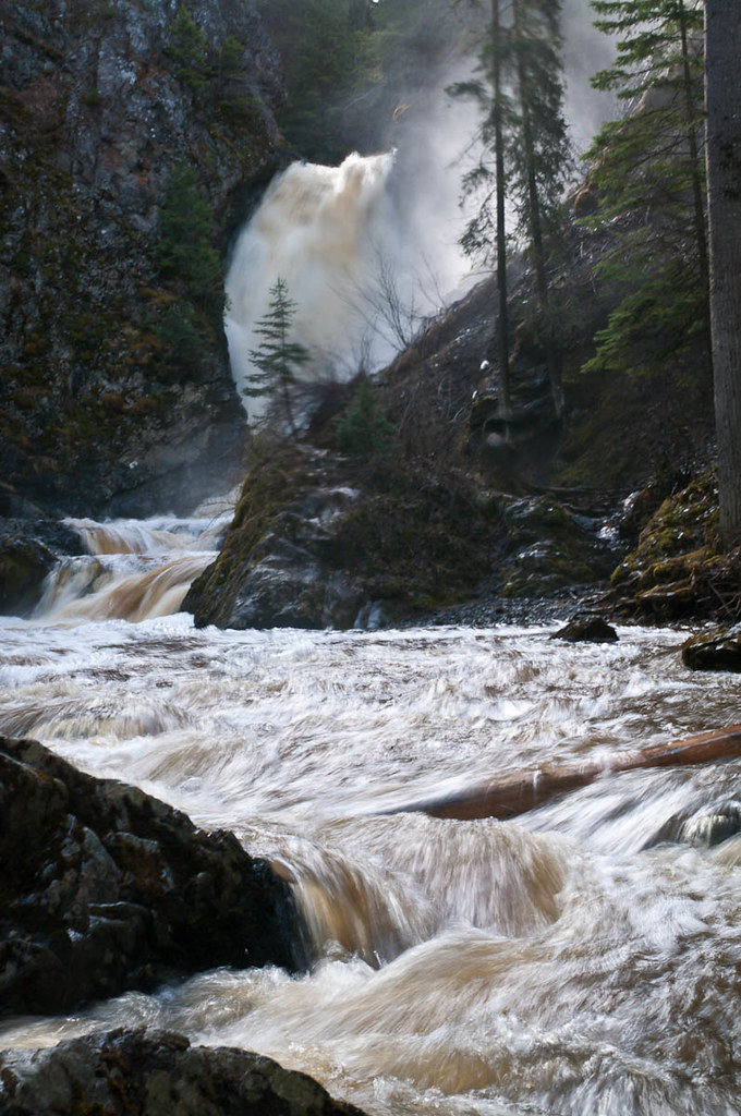 Photo: John Freeland · CC BY 2.0Waterfalls · Hixon & Quesnel
Hixon Falls
A short path leads into the Hixon Creek canyon to the lower waterfall. This is a useful stop on the Highway 97 corridor, with a separate short walk to Hixon Chutes nearby.…
Easy / 0.24 km round tripRead guide →- Walks · Hixon & Quesnel
Hixon Chutes
Hixon Chutes is the second short creek walk near Hixon Falls. Its destination is a constricted section of the gorge where the water funnels between rock walls. The path has more…
Read the access and route notesRead guide → - Hikes · Blackwater & southwest
Alexander Mackenzie Heritage Trail
Local day walks follow part of the much longer Nuxalk-Carrier Grease Trail through the Blackwater country. The historic route predates Alexander Mackenzie’s guided journey and…
Moderate / Variable, 3 to 16 km depending on trails takenRead guide → - Camping · Blackwater & southwest
Mackenzie Lakes recreation sites
Two small campsites serve connected fishing lakes southwest of Prince George. Despite the name, these are on the Blackwater road corridor, not in the town of Mackenzie.
Camping destination · access & overnight informationRead guide → - Camping · Blackwater & southwest
Punchaw Lake recreation site
A small forest-sheltered lakeside campsite along the Blackwater road corridor. It provides a rustic overnight stop and lake access rather than a documented long walking trail.
Camping destination · access & overnight informationRead guide → - Viewpoints · Blackwater & southwest
Fort George Canyon
A forest walk descends from the plateau to a dramatic reach of the Fraser River that once challenged sternwheelers. The steepest work comes on the return climb from the river, and…
Moderate / 13.1 km round trip / 404 m gainRead guide →