Trail clearing
The source records trail clearing in August 2024. Later blowdown and maintenance have not been confirmed by this report.
Notice or observation: 2024-08 · Source checked October 17, 2026 · Caledonia Ramblers (opens original source)Steep forest ascent toward mountain views; the source reports no water along the route.
Sources reviewed . This is a research date, not a trail inspection.
The locations GPX contains sourced points with their recorded roles. It contains no trail track or connecting route.
A full-route elevation profile is not available yet.
A reusable trail line has not yet been verified for this outing. Any location pin shows the published location described above; it does not draw the hike or establish a navigable approach.
Follow Highway 16 east 18 km, then Upper Fraser Road for 60 km. At the fork keep left across the bridge, then turn right onto Church FSR. Continue toward Longworth as the road names change through Longworth, McGregor and Upper Fraser. Beyond Longworth take Fraser Flats FSR on the left. The source approach passes a gate and railway tracks; about 300 m beyond the tracks, park in the widening on the right. The trail begins opposite, beside a small hiker sign. Gate and rail access need current confirmation.
Map position: 53.90686, -121.41846 · start point of published trip track (parking unverified). Embedded trip-map feature 'Baldy Track 2023-06-07 12:59:08 p.m.': first recorded coordinate [-121.418463, 53.906858]. Point extracted from the original public trip map. A track start is evidence of where recording began, not certification of parking, legal access, road suitability or the complete route.
From the small hiker sign opposite the roadside parking, follow the forest ascent toward the upper mountain and viewpoints over the Fraser Valley. This is a sustained, strenuous climb with very steep and brushy sections, rather than a gentle ridge walk. The published outing is about 14 km return with approximately 1,370 m of gain; the prose rounds the climbing to 1,300 m. The source specifically reports no water along the route, so carry the full amount needed for the ascent and descent. Return by the same trail and allow time for the steep downhill. A clearing report from August 2024 is historical evidence and does not establish that later blowdown has been removed.
Retrace the ascent to the same roadside start. The published outing is 14 km return; the steep descent still needs substantial time.
Terrain: steep ascent · brushy sections.
14 km round trip
1370 m
The Caledonia Ramblers Baldy Mountain metric panel gives 1,370 m ascent, while its prose rounds the ascent to 1,300 m.
The reviewed guide provides a hiking route, not a separately verified winter line. The long, steep ascent and lack of water matter in warm weather, while snow or poor visibility can complicate finding the return path.
The source records trail clearing in August 2024. Later blowdown and maintenance have not been confirmed by this report.
Notice or observation: 2024-08 · Source checked October 17, 2026 · Caledonia Ramblers (opens original source)These are dated research notes. Open the trip planner for current available weather and advisory feeds; no alert found does not establish that a trail or road is open.
On-route camping permission has not been established for this outing. Check the relevant land manager before planning an overnight stay; a mapped lake, cabin or previous tent location does not confirm permission.
A photograph with confirmed reuse permission has not yet been added to this guide.
These photographs provide context; they do not establish the appearance of this selected route or facility.
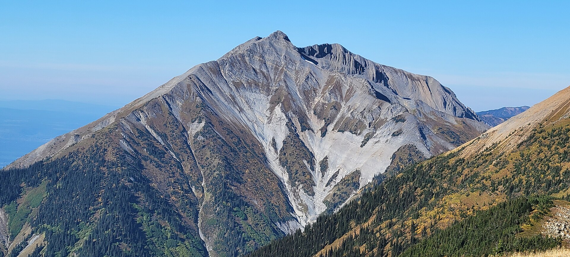
These galleries stay on their photographers’ original websites.
Choose a trip pack or an available individual sheet for your map case.
Descriptions are written for this guide from the linked evidence. Source review dates, published reports and field observations can differ. Photographs and route lines retain their own attribution and reuse terms.
Steep ascent to ridge and renovated lookout; source reports no summer water near cabin.
Hard / 16 km round trip / Not established gainRead guide →The Viking approach climbs through forest and the wet Caribou Meadows before reaching a small lake below the summit. This outing turns at the lake and returns by the same trail.
11 km round trip / Not established gainRead guide →Turn around at Caribou Meadows on the lower part of the Viking route, before the lake and summit. The forest approach still involves a substantial climb, followed by wet meadow…
6 km round trip / Not established gainRead guide →Climbs through Caribou Meadows to lake and ridge; rough connector to Sugarbowl is a separate traverse.
Hard / 14 km round trip / 1,110 m gainRead guide →Climb through forest, Caribou Meadows and the lake basin before tackling Viking’s less clearly marked upper slopes. Return by the same approach; lingering snow and poor visibility…
Hard / 13 km round trip / Not established gainRead guide →Link the Viking and Sugarbowl routes on a mountain traverse between two Highway 16 trailheads. The rough connecting ground needs careful navigation, and the finish requires…
Read the access and route notesRead guide →