George Hicks Park
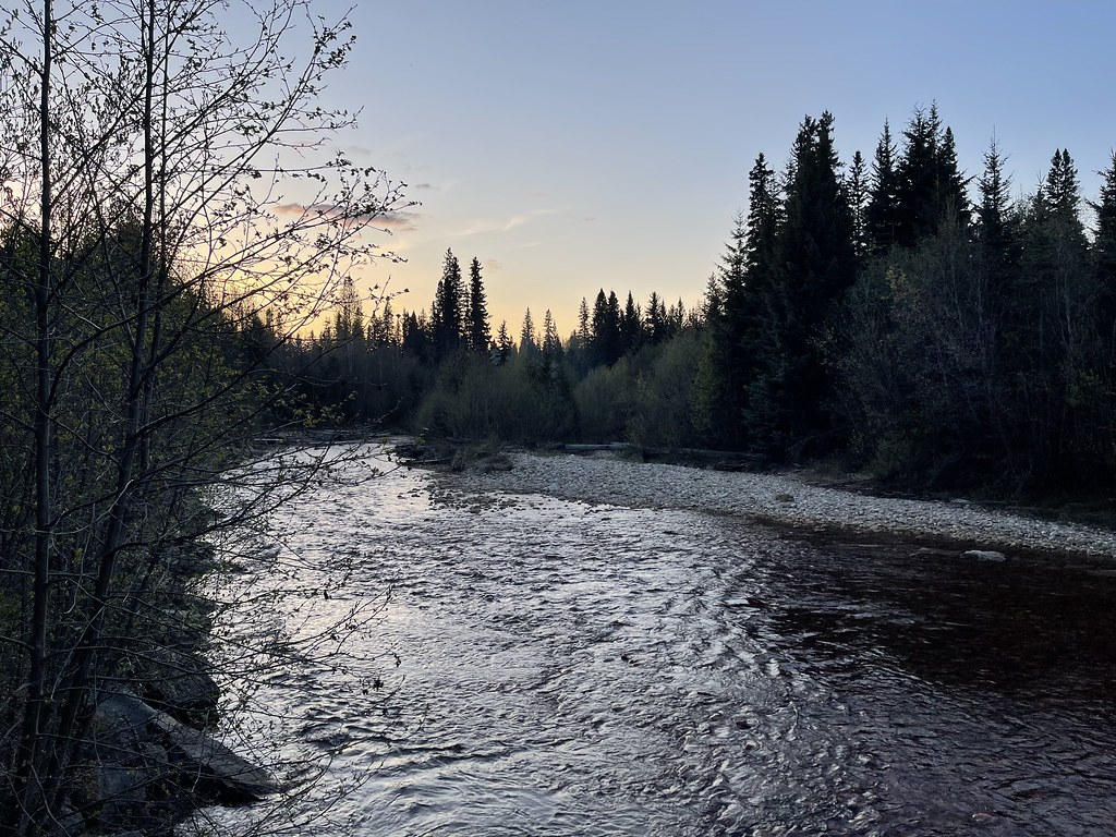
Short marsh path beside Swift Creek salmon viewpoint.
Sources reviewed . This is a research date, not a trail inspection.
- Distance
- 0.6 kmRound trip
- Elevation gain
- Not establishedLittle climb indicated by the terrain model (under 10 m); exact gain is unresolved.
- Walking time
- 5–10 minutesplus wildlife-viewing stops
- Difficulty
- EasyOut and back
How the elevation gain was established
Outing: out-and-back outing from Swift Creek side of George Hicks Park to Visitor-centre side of the wetland trail and back; 0.57 km along the mapped itinerary
Copernicus DEM 2021 GLO-90 via Open-Meteo (90 m resolution). v7-smoothed-ascent-1: interpolate retained terrain samples at 100 m spacing; apply one triangular 1:2:1 smoothing pass over ±100 m; preserve start, finish and documented turnaround heights; sum uphill excursions with a 5 m reversal threshold; round to nearest 10 m.
Approximate terrain-model ascent, not a field or GPS measurement. Coarse cells and smoothing can miss small climbs, switchbacks, structures and sharp terrain. Processing sensitivity is not a statistical confidence interval.
Sources checked 2026-10-19.
Map & elevation
Elevation profile
Full round trip · approximately 0.6 km mapped
Approximate terrain elevation. Mapped distance may differ from the published hike distance.
Map and elevation sources
Approximate ground elevation from a 90 m terrain model. Distance follows the mapped itinerary and may differ from published walking distance. This is a terrain-model profile, not a surveyed measurement. Any ascent total is identified separately with its own source or estimation method.
The local guide’s trailhead coordinate is on the Swift Creek side,16m from the named salmon-viewing trail. The opposite end reaches the visitor-centre side, corroborated by the mapped Valemount Visitor Centre building. A return along this short wetland corridor is0.574km, consistent with the guide’s600m outing. No additional salmon-platform or village sidewalk paths are included.
Route source 1Route source 2Route source 3Route source 4Route source 5Copernicus GLO-90 terrain elevations via Open-Meteo (CC BY4.0); linework: Open Database License (ODbL) 1.0 · checked 2026-10-18 · CC BY4.0 elevation data; Open Database License (ODbL) 1.0 linework. Copernicus DEM 2021 GLO-90 via Open-Meteo. Linework source: https://www.openstreetmap.org/way/619343191. Sampled and rounded for display.
Complete mapped outing from Swift Creek side of George Hicks Park, including the return on the same route. Line source (opens original source).
Getting there & parking
From Valemount Visitor Centre, follow the salmon-viewing signs downhill toward Swift Creek for about 250 m. Parking is described beside the creek near the highway overpass, with the northern trail entrance at that lot. A second entrance lies just below the visitor centre; use the signed paths rather than the highway shoulder.
Estimated drive from Prince George: 3 hr 58 min · 292.1 km. Modeled one-way driving time from Prince George City Hall, using mapped road speeds. Forest-road sections can take substantially longer: surface, clearance, radio procedures, gates, washouts, plowing, and legal access are not verified by the router. No live traffic or invented forest-road multiplier is included. Allow extra time and check the dated access notes.
Map position: 52.83358, -119.28187 · trailhead. source-published; not field-verified
On the trail
Follow the short wetland path between the visitor-centre side and the Swift Creek salmon-viewing area. The return outing is about 600 m with little overall climbing. The route offers close views of marsh habitat, including small birds, amphibians and insects, and the adjacent platform provides a place to watch salmon without entering the creek. Chinook viewing is usually best from mid-August into mid-September. Wet periods can leave muddy sections, so a short distance does not guarantee a firm walking surface throughout.
Accessibility
YORA lists the route as accessible, but reports grades around 10% and muddy patches after rain. The Visitor Centre has the nearest public bathroom.
Conditions & seasons
The local guide recommends spring through autumn for ordinary walking. Wetland conditions can be muddy after rain, and mosquitoes are common in warm weather. Salmon timing varies; the published viewing window is seasonal rather than a guarantee for a particular day.
These are dated research notes. Open the trip planner for current available weather and advisory feeds; no alert found does not establish that a trail or road is open.
Camping & overnight plans
On-route camping permission has not been established for this outing. Check the relevant land manager before planning an overnight stay; a mapped lake, cabin or previous tent location does not confirm permission.
Photos of George Hicks Park
Take this guide with you
Choose a trip pack or an available individual sheet for your map case.
Sources, dates & research notes
Descriptions are written for this guide from the linked evidence. Source review dates, published reports and field observations can differ. Photographs and route lines retain their own attribution and reuse terms.
- https://hikevalemount.com/george-hicks-park/ (opens original source)
- https://routing.openstreetmap.de/about.html (opens original source)
- https://open-meteo.com/en/licence (opens original source)
- https://open-meteo.com/en/docs/elevation-api (opens original source)
OpenStreetMap line references (4)
These contributor-mapped features support the map geometry. They are separate from the written access and route sources.
Nearby and related guides
- Walks · Valemount & Mount Robson
Big Foot Trail Loop
Village circuit with paved connections and interpretive stops.
Easy / 3.64 km loopRead guide → - Viewpoints · Valemount & Mount Robson
Swift Creek Lookout
Creekside first kilometre then steep climb to viewpoint.
Moderate / 3.6 km round trip / 37 m gainRead guide → - Hikes · Valemount & Mount Robson
Swift Creek Loop
Follow trail6 markers through bike-trail intersections and suspension-bridge circuit.
Moderate / 8.5 km loop / 150 m gainRead guide → - Waterfalls · Valemount & Mount Robson
Zen Garden via access trails
Approach paths lead to boardwalks and small stream cascades.
Moderate / 4 km round trip / 120 m gainRead guide → - Hikes · Valemount & Mount Robson
Selwyn Traverse
Forest traverse toward Kinbasket Lake; arrange return transport.
Moderate / 9.7 km point to point / 200 m gainRead guide →  Photo: Rufus Hawthorne · CC BY-SA 3.0Hikes · Valemount & Mount Robson
Carson's Peak / McKirdy summit extension
Carson's Peak adds450m climbing from col; main McKirdy summit more technical.
Read the access and route notesRead guide →