Mapped named trail sections. Only the named Lake Joan path is identified here. The Canary Falls branch and a complete Stone Corral circuit are not established by this line. Line source (opens original source).
Use the shared Stone Corral/Lake Joan parking on Kinuseo Falls Road shortly after entering Monkman Park, about 62 km from Tumbler Ridge. The Lake Joan trail begins across the road and slightly left of the Stone Corral parking. The access page uses inconsistent road-kilometre references, so the signed shared trailhead is the useful final landmark.
Map position: 54.77069, -121.17211 · shared parking. WNMS explicitly says Lake Joan/Canary Falls and Stone Corral share a parking lot. The coordinate is the Stone Corral parking marker; Lake Joan trail begins across the road.
On the trail
At the early fork, keep right for the recommended counterclockwise loop toward Lake Joan.
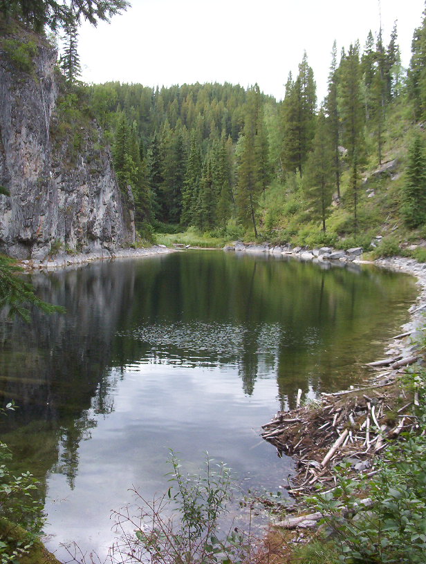
At the lake, go left toward the small spring, then follow the path over the rise and across the inlet creek.
At the T-junction, turn left toward Canary Falls. The right branch is an optional additional lakeshore visit.
Climb the steep path beside the falls to return toward the first fork and trailhead.
Full route notes
Enter the forest and reach the main fork shortly after starting. For the recommended counterclockwise circuit, keep right, cross the small creek and follow the marked route over ridges before descending steeply to Lake Joan. Turn left along the shore toward the small spring, then climb briefly and descend across the main inlet creek to a T-junction. A right turn visits another lakeshore section beneath limestone cliffs; turn left for the forested gorge and Canary Falls. The climb beside the falls is steep and often slippery, after which the path returns to the first fork and trailhead. For a shorter direct falls visit, the left branch at the initial fork crosses the bridge and reaches the falls lip within about 100 m.
The way back
The main outing is a circuit. For a shorter falls-only visit, the initial left branch crosses the bridge and reaches the falls lip in roughly 100 m; its return is along that same branch.
Conditions & seasons
The route contains steep descents and a slippery climb beside the falls; wet weather and ice can change its difficulty substantially. The lakeshore is not a flat, barrier-free circuit.
These are dated research notes. Open the trip planner for current available weather and advisory feeds; no alert found does not establish that a trail or road is open.
Descriptions are written for this guide from the linked evidence. Source review dates, published reports and field observations can differ. Photographs and route lines retain their own attribution and reuse terms.