Tumbler Ridge & Monkman
Find waterfalls, canyons and mountain walks around Tumbler Ridge and Monkman. Some destinations are reached from town roads; others involve long drives on resource roads. Read the approach and dated closure notes before selecting a waterfall or backcountry itinerary.
38 of 38 places
Open map search →- camping · Tumbler Ridge & Monkman
Hugh Lake Camp
Official Monkman map marks camp at trail km 33; these are route-chainage values, not road distances.
Read the approach and route notesRead guide → - camping · Tumbler Ridge & Monkman
Monkman Lake Camp
Official Monkman map marks camp at trail km 25; these are route-chainage values, not road distances.
25 km point to point · Approx. 460 m gainRead guide → - camping · Tumbler Ridge & Monkman
Devil’s Creek Camp
Official Monkman map marks camp at trail km 22; these are route-chainage values, not road distances.
22 km point to point · Approx. 410 m gainRead guide → - camping · Tumbler Ridge & Monkman
Cascades Camp
Official Monkman map marks camp at trail km 20; these are route-chainage values, not road distances.
20 km point to point · Approx. 400 m gainRead guide → - camping · Tumbler Ridge & Monkman
Trot Camp
Official Monkman map marks camp at trail km 15; these are route-chainage values, not road distances.
15 km point to point · Approx. 300 m gainRead guide → - camping · Tumbler Ridge & Monkman
Murray River Camp
Official Monkman map marks camp at trail km 7; these are route-chainage values, not road distances.
Read the approach and route notesRead guide → - hike · Tumbler Ridge & Monkman
Monkman Pass Memorial through-route
Unmaintained beyond Monkman Lake; park page describes a 63 km route continuing to Hobies cabin on the Herrick River.
63 km point to pointRead guide → - waterfall · Tumbler Ridge & Monkman
Monkman Cascades
Waterfall branches leave the main Monkman Lake trail. Source lists access near km 18, 21 and 22.
45 km round trip · 3 daysRead guide → - hike · Tumbler Ridge & Monkman
Monkman Lake
Long forest backpacking route via Murray River suspension bridge, a limestone ridge and the Cascades area to the lake.
50 km round trip · 465 m gain · 4 or more days with explorationRead guide → - hike · Tumbler Ridge & Monkman
Monkman Tarns
Beyond Monkman Lake the route enters subalpine terrain and requires independent navigation.
60 km round trip · 4 daysRead guide → - camping · Tumbler Ridge & Monkman
Kinuseo Falls campground
Closure notice recorded · check guideKinuseo Falls Road, 60 km south of Tumbler Ridge; allow for rough road.
Camping destination · access & overnight informationRead guide → - waterfall · Tumbler Ridge & Monkman
Lake Joan and Canary Falls
A lake-and-waterfall circuit with short steep sections; a shorter fork reaches the top of Canary Falls.
Moderate · 2 km loop · 60 m gainRead guide → 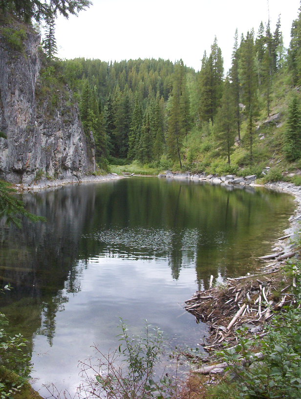 Photo: RPlunk at English Wikipedia · Public domainviewpoint · Tumbler Ridge & Monkman
Stone Corral
Interpretive circuit through limestone features, ponds and cliffs; caves and springs are linked points of interest rather than independent hikes.
Moderate · 3 km round trip · 230 m gain · 2–3 hoursRead guide →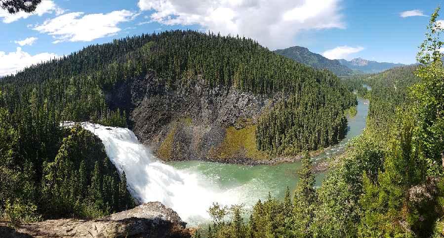 Photo: Happendstoday · CC BY-SA 4.0waterfall · Tumbler Ridge & Monkman
Kinuseo Falls
Closure notice recorded · check guideSeveral walks reach viewpoints of Kinuseo Falls. BC Parks confirms the main viewing platform is closed for the 2026 season; the upper viewpoints use a more demanding trail.
0.5 km round tripRead guide →- hike · Tumbler Ridge & Monkman
Windfall Lake
Forest and meadow approach reaches the alpine lake. A higher return loop and mountain extensions require stronger navigation skills.
10 km round trip · 414 m gain · 5–7 hoursRead guide → - waterfall · Tumbler Ridge & Monkman
Barbour Falls
Mostly level forest approach to a canyon-side waterfall viewpoint, with a short side branch to a smaller fall.
Easy · 1.6 km round trip · Approx. 30 m gain · About 1 hour returnRead guide → - waterfall · Tumbler Ridge & Monkman
Wapiti Falls spur
A waterfall viewpoint reached by a short side path after a substantial walk along the remote Wapiti River trail.
Read the approach and route notesRead guide → - hike · Tumbler Ridge & Monkman
Wapiti Lake–Onion Lake
Remote backpacking trail along the Wapiti River and lakes. Motorized off-road vehicles are prohibited in the park.
6–9 hours one way to Wapiti LakeRead guide → - waterfall · Tumbler Ridge & Monkman
Bullmoose Falls
Short waterfall approach requires crossing Bullmoose Creek; high water can make the route impassable.
ModerateRead guide → - hike · Tumbler Ridge & Monkman
Bootski Lake
Logging-road approach climbs into alpine terrain beneath Wapitik Mountain. Established tent pads, food storage and toilet are described.
Hard · 11 km round trip · 550 m gain · About 5 hours returnRead guide → - waterfall · Tumbler Ridge & Monkman
Nesbitt’s Knee Falls
Ridge walk reaches a viewing bench, with separate upper-creek and much steeper base options.
Moderate · 3 km round tripRead guide → - hike · Tumbler Ridge & Monkman
Mount Kostuik Hidden Valley
An old exploration road climbs to a subalpine meadow before a scramble toward Mount Kostuik’s rocky summit. The direct return, Hidden Valley loop and Windy Ridge traverse are…
Read the approach and route notesRead guide → - waterfall · Tumbler Ridge & Monkman
Babcock Falls
Boardwalks cross wet ground on the approach to a waterfall viewpoint. The descent below the viewpoint is a materially steeper variant.
Moderate · 2.2 km round trip · Approx. 50 m gainRead guide → - hike · Tumbler Ridge & Monkman
Mount Spieker
Old exploration roads reach an alpine saddle with north, southwest and summit-ridge choices.
Moderate · 6 km round trip · 330 m gain · 3–4 hoursRead guide →