Mapped portion · walking direction unconfirmed · 62.35 km
This chart covers only part of the route. It does not establish the full hike or a return journey.
Coverage and elevation sources
62.35 km along source section 1 of 1, in its mapped direction. Approximate 90 m terrain model along this mapped section. Separate sections are not joined. This chart does not measure total trail ascent or establish current access; use the guide’s published outing measurements.
An approximately 8.4 km point-to-point segment near the northern end of the traverse. It is only part of the much longer Moose River journey and does not include the highway approach, full exit or vehicle shuttle.
Mapped named trail. The source-labelled Moose River route joins the Berg Lake corridor. This remote through-route still requires current crossing, permit, park and shuttle checks; a line does not establish that crossings are passable. Line source (opens original source).
Getting there & parking
Use the Moose River access at Highway 16 and locate the registration kiosk north of the railway.
For a traverse, arrange the separate Berg Lake road-end pickup before departure; the two trailheads are not the same parking lot.
Parking: The Moose River route starts north of the Canadian National railway at the Moose River–Highway 16 junction. Register at the trailhead kiosk.
Full access notes
The starting kiosk is at the Moose River–Highway 16 junction, on the north side of the Canadian National Railway tracks. Confirm the signed access and parking with Mount Robson Welcome Centre before departure. A through-trip exits at the Berg Lake Trail parking on Kinney Lake Road rather than returning to this highway junction.
Map position: 52.92444, -118.80821 · mapped trailhead north of railway; road parking separate. OSMnode12648285062 is named Moose River Route and classified highway=trailhead; official BC Parks East End Wilderness Trails places the route north of the railway beside Moose River/Hwy16.
Source-backed reference location; current access, exact parking and field position not independently verified.
On the trail
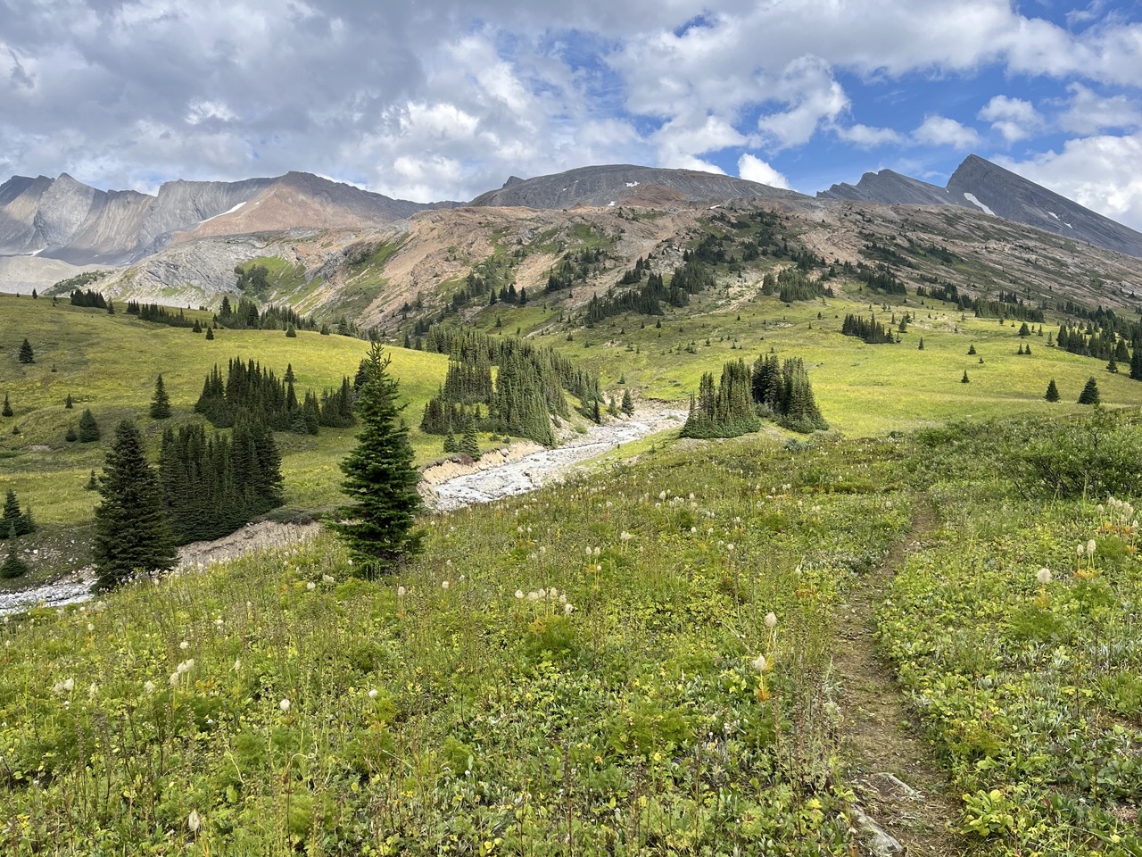
Follow the route generally north beside Resplendent Creek and the Moose River. Gravel flats and marsh bypasses can have no visible trail.
The official route lists camps at 4.2 km, Resplendent Creek at 15.3 km, Trio Mountain at 26 km, Steppe Creek at 38 km and Slide Lake at 43 km.
The Alberta boundary is approximately 49 km from the trailhead. The route includes numerous hazardous river crossings; BC Parks identifies 16 and recommends late summer or very early fall.
Beyond the border, descend Calumet Creek toward the Smokey River, then cross back into British Columbia toward Berg Lake.
BC Parks places Calumet Creek camp at 52 km, Adolphus at 61.5 km and Berg Lake campground at about 66 km. Exit by the additional Berg Lake corridor stage to Kinney Lake Road.
Full route notes
Register at the trailhead kiosk, then follow the user-maintained route generally north beside Resplendent Creek and the Moose River. The Alberta border is roughly 49 km from the highway trailhead. The path is not continuous or obvious across gravel flats and marshy sections; this is a navigation-intensive wilderness route with 16 river crossings in the official description. Beyond the border, continue through Jasper National Park down Calumet Creek toward the Smokey River, then re-enter British Columbia and join the Berg Lake corridor. BC Parks gives about 66 km from the Moose River trailhead to Berg Lake campground; descending the Berg Lake Trail to its road-end parking adds another substantial stage. The two vehicle endpoints are separate, so arrange the road shuttle before departure.
The way back
This is a through-trip. The published 66 km ends at Berg Lake campground and excludes the remaining descent to road-end parking and the road transfer back to the Moose River start.
Terrain: unbridged river crossings · remote navigation.
Conditions & seasons
BC Parks recommends late summer to the beginning of autumn because river crossings are most hazardous during high water. Heavy rain can raise crossings in any month. There is no regular park patrol, and the official source does not recommend off-season use.
Robson watercraft and wading equipment restriction
From May 4, 2026, BC Parks prohibits watercraft and wading equipment throughout Mount Robson Park waters to limit aquatic disease spread. This includes powered and unpowered craft, inflatables, wading clothing and boots. The hiking trails are not closed by this notice.
BC Parks recommends this route only in late summer or very early fall and advises against the off-season traverse.
These are dated research notes. Open the trip planner for current available weather and advisory feeds; no alert found does not establish that a trail or road is open.
BC Parks lists rustic camps at approximately 4.2 km, Resplendent Creek 15.3 km, Trio Mountain 26 km, Steppe Creek 38 km and Slide Lake 43 km from the Moose River start. The basic toilets, food caches and fire circles are not maintained by BC Parks. A through-trip adds Jasper camps such as Calumet Creek and Adolphus, which require a Parks Canada backcountry permit; Berg Lake Trail camps require the applicable BC Parks reservation or registration. The presence of a fire circle does not override current fire restrictions.
Descriptions are written for this guide from the linked evidence. Source review dates, published reports and field observations can differ. Photographs and route lines retain their own attribution and reuse terms.