A compact volcanic summit outing with views around Summit Lake. The trail is being rerouted onto a longer, gentler ascent, so older distance estimates and track lines may describe a previous alignment.
Sources reviewed . This is a research date, not a trail inspection.
Mapped portion · walking direction unconfirmed · 1.47 km
This chart covers only part of the route. It does not establish the full hike or a return journey.
Coverage and elevation sources
1.47 km along source section 1 of 1, in its mapped direction. Approximate 90 m terrain model along this mapped section. Separate sections are not joined. This chart does not measure total trail ascent or establish current access; use the guide’s published outing measurements.
Mapped named trail. The mapped summit paths may predate the longer, gentler reroute described by RSTBC; follow current signed routing and posted works notices. Line source (opens original source).
Getting there & parking
The historical driving description is Highway 97 north for about 52 km, left onto Tallus Road for approximately 850 m, then right onto Caine Creek Road for 5.5 km to parking. That same source retains a May 2021 notice that Caine Creek Road was closed at its beginning because of poor condition. The current recreation-site listing describes the trail resource as open but does not independently resolve that old road notice. Confirm the present legal road approach and signed entrance before relying on the historical turn sequence.
Map position: 54.32707, -122.67108 · recreation project location. Source-published recreation project point; not verified parking or trailhead.
Trail access · 54.32706, -122.67091. Named point on source trip map; position and feature type retained as factual observations. Location source (opens original source)
On the trail
From the current signed trailhead, follow the open marked route toward the summit viewpoints and return on the designated descent. Recent RSTBC information describes a longer, less steep alignment under continuing work, with further completion expected in 2027. Follow work-site signs rather than using an old track to cut onto a closed or unfinished section. Earlier descriptions emphasize steep climbing and list approximately 3 km for the outing; those measurements may no longer describe the full current alignment. The public updates do not yet supply a verified new junction sequence or complete replacement GPX, so retain that uncertainty when planning time and effort.
Terrain: rough route.
Distance and elevation source notes
10Adventures publishes 2.8 km return and 177 m cumulative ascent for its viewpoint out-and-back. Caledonia Ramblers gives 3 km. Optional summit-rim loops differ.
The published gain is not a summit altitude. The existing source line may predate the longer RSTBC reroute, so a current complete route profile is still unverified.
Conditions & seasons
Season-specific access has not been established in this guide. Read the dated notices and original land-manager information before choosing a departure date.
Historical Caine Creek Road closure
The club retains a May 2021 notice of closure at the beginning of Caine Creek Road because of road condition. Current status and alternate legal access remain unresolved.
The current RSTBC resource page describes a longer, gentler ascent created by recent rerouting and says further work is expected to finish in 2027. Its resource status is open, but the page advises care around the work. Older distances and route lines may describe the previous alignment.
These are dated research notes. Open the trip planner for current available weather and advisory feeds; no alert found does not establish that a trail or road is open.
On-route camping permission has not been established for this outing. Check the relevant land manager before planning an overnight stay; a mapped lake, cabin or previous tent location does not confirm permission.
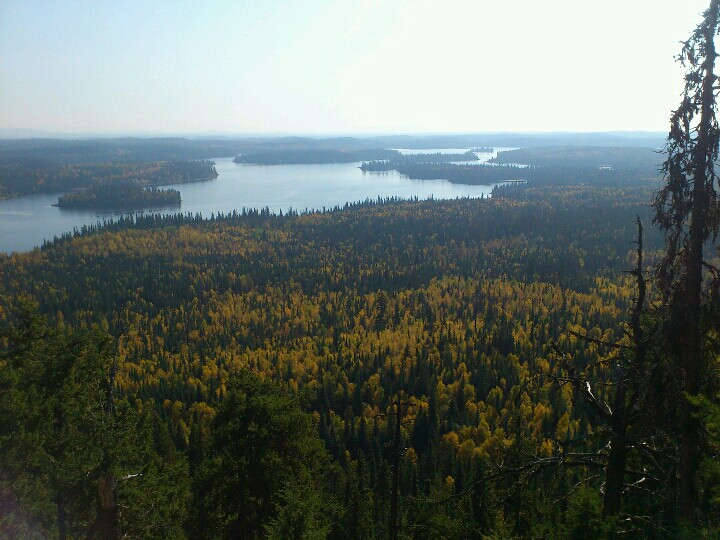
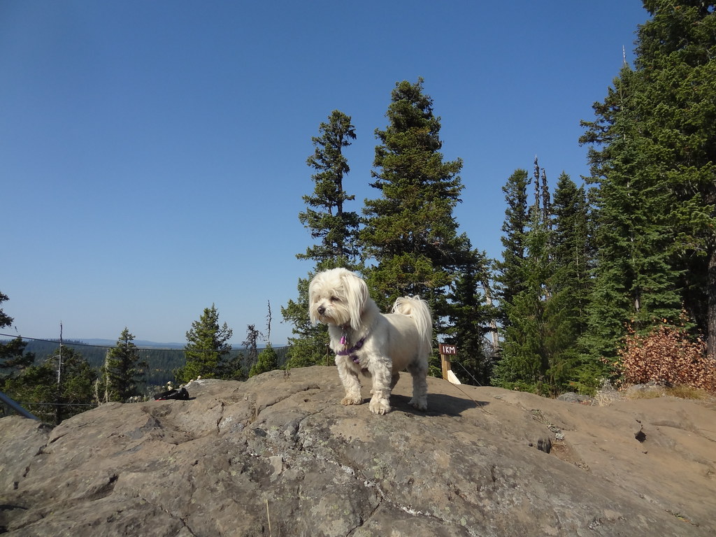
Photos of Teapot Mountain
Lake and forest views from Teapot Mountain, 23 September 2012.photo-2012-09-23-13-20-40-190 (opens original source) · Andrew Kurjata · CC BY-NC-SA 2.0 (opens original source) · 2012-09-23. Provider display size downloaded; no local edits. Display may crop the view. Adaptations retain the image licence. · Noncommercial onlyA rocky viewpoint on Teapot Mountain, 23 September 2012, with the photographer’s dog in the foreground.DSC03014 (opens original source) · Andrew Kurjata · CC BY-NC-SA 2.0 (opens original source) · 2012-09-23. Provider display size downloaded; no local edits. Display may crop the view. Adaptations retain the image licence. · Noncommercial only
Original photo galleries
These galleries stay on their photographers’ original websites.
Descriptions are written for this guide from the linked evidence. Source review dates, published reports and field observations can differ. Photographs and route lines retain their own attribution and reuse terms.