Viking Ridge — Viking Lake
Climb the northwest side of Viking Ridge through forest to Caribou Meadows. A plankway has been built through wet parts of the meadows, with work reported from 2020 onward. Continue from the meadow through the upper trail to the small lake, then return by the same route. This option stops before the summit slope. The 2002 park brochure places the lake around 5.5 km from the trailhead, while the present club description identifies roughly 855 m of gain to the lake. The trail beyond the meadows is described as rougher than the lower approach.
Sources reviewed . This is a research date, not a trail inspection.
The locations GPX contains sourced points with their recorded roles. It contains no trail track or connecting route.
- Distance
- 11 kmRound trip
- Elevation gain
- Not establishedThe source lists 869 m with the outward route. Any climbing on the return is not established; this is not a verified complete-return total.
- Walking time
- Not published
- Difficulty
- Not ratedOut and back
one way, February 2002 park brochure The round-trip distance is calculated from the published one-way length.
Map & elevation
Elevation profile
A full-route elevation profile is not available yet.
A reusable trail line has not yet been verified for this outing. Any location pin shows the published location described above; it does not draw the hike or establish a navigable approach.
Getting there & parking
Follow Highway 16 east from Prince George to the Viking Ridge access, about 5 km beyond the Sugarbowl trailhead. The park brochure places the parking area on the north side of the highway and the trail sign at the highway cutbank. Identify the signed trail and take care at the highway crossing; this is separate from the Sugarbowl parking lot and the Hungary Creek road.
Driving access has not been established for this selected route option; check its original sources.
Map position: 53.87144, -121.58033 · destination reference point. Converted from official degrees-decimal-minutes; datum unstated; not field-verified This point is not a confirmed starting point for the selected route option.
On the trail
Climb the northwest side of Viking Ridge through forest to Caribou Meadows. A plankway has been built through wet parts of the meadows, with work reported from 2020 onward. Continue from the meadow through the upper trail to the small lake, then return by the same route. This option stops before the summit slope. The 2002 park brochure places the lake around 5.5 km from the trailhead, while the present club description identifies roughly 855 m of gain to the lake. The trail beyond the meadows is described as rougher than the lower approach.
Conditions & seasons
The higher slopes can retain snow after the lower forest is clear. Snow on the slope beyond the lake may be hard and icy, and winter travel adds avalanche exposure. Use a separately assessed snow route rather than assuming the summer summit approach is suitable in winter.
These are dated research notes. Open the trip planner for current available weather and advisory feeds; no alert found does not establish that a trail or road is open.
Camping & overnight plans
No designated tent pads or cabin were verified at Caribou Meadows or Viking Lake. The park’s published developed backcountry camping locations are Raven Lake and Grizzly Den; those are different approaches, not nearby road-accessible camps on this hike.
Photos of Viking Ridge — Viking Lake
A photograph with confirmed reuse permission has not yet been added to this guide.
Original photo galleries
These galleries stay on their photographers’ original websites.
- Viking Ridge September 20, 2026 (opens original source) · Caledonia Ramblers
- Viking Ridge April 11, 2026 (opens original source) · Caledonia Ramblers
- Viking Ridge March 15, 2025 (opens original source) · Caledonia Ramblers
- Viking Ridge September 28, 2024 (opens original source) · Caledonia Ramblers
- Work Hike September 16, 2023 (opens original source) · Caledonia Ramblers
- Work Hike September 9, 2023 (opens original source) · Caledonia Ramblers
- Viking Ridge July 10, 2022 (opens original source) · Caledonia Ramblers
- Viking Ridge February 26, 2022 (opens original source) · Caledonia Ramblers
- Viking Ridge December 12, 2021 (opens original source) · Caledonia Ramblers
- Viking Ridge Work Hike September 11, 2021 (opens original source) · Caledonia Ramblers
- Viking Ridge November 1, 2020 (opens original source) · Caledonia Ramblers
- Viking Ridge December 8, 2019 (opens original source) · Caledonia Ramblers
- Viking Ridge April 21, 2019 (opens original source) · Caledonia Ramblers
Take this guide with you
Choose a trip pack or an available individual sheet for your map case.
Sources, dates & research notes
Descriptions are written for this guide from the linked evidence. Source review dates, published reports and field observations can differ. Photographs and route lines retain their own attribution and reuse terms.
- https://nrs.objectstore.gov.bc.ca/kuwyyf/sugarbowl_grizzlyden_brochure_53146eed08.pdf (opens original source)
- https://bcparks.ca/sugarbowl-grizzly-den-park/ (opens original source)
- https://nrs.objectstore.gov.bc.ca/kuwyyf/sugarbowl_grizzlyden_waypoints_c18ea15d07.pdf (opens original source)
- https://routing.openstreetmap.de/about.html (opens original source)
- https://caledoniaramblers.ca/trails/viking-ridge (opens original source)
Nearby and related guides
- Hikes · Upper Fraser & Sugarbowl
Viking Lake
The Viking approach climbs through forest and the wet Caribou Meadows before reaching a small lake below the summit. This outing turns at the lake and returns by the same trail.
11 km round trip / Not established gainRead guide → - Hikes · Upper Fraser & Sugarbowl
Viking meadows
Turn around at Caribou Meadows on the lower part of the Viking route, before the lake and summit. The forest approach still involves a substantial climb, followed by wet meadow…
6 km round trip / Not established gainRead guide → - Hikes · Upper Fraser & Sugarbowl
Viking summit
Climb through forest, Caribou Meadows and the lake basin before tackling Viking’s less clearly marked upper slopes. Return by the same approach; lingering snow and poor visibility…
Hard / 13 km round trip / Not established gainRead guide → - Hikes · Upper Fraser & Sugarbowl
Viking–Sugarbowl traverse
Link the Viking and Sugarbowl routes on a mountain traverse between two Highway 16 trailheads. The rough connecting ground needs careful navigation, and the finish requires…
Read the access and route notesRead guide → 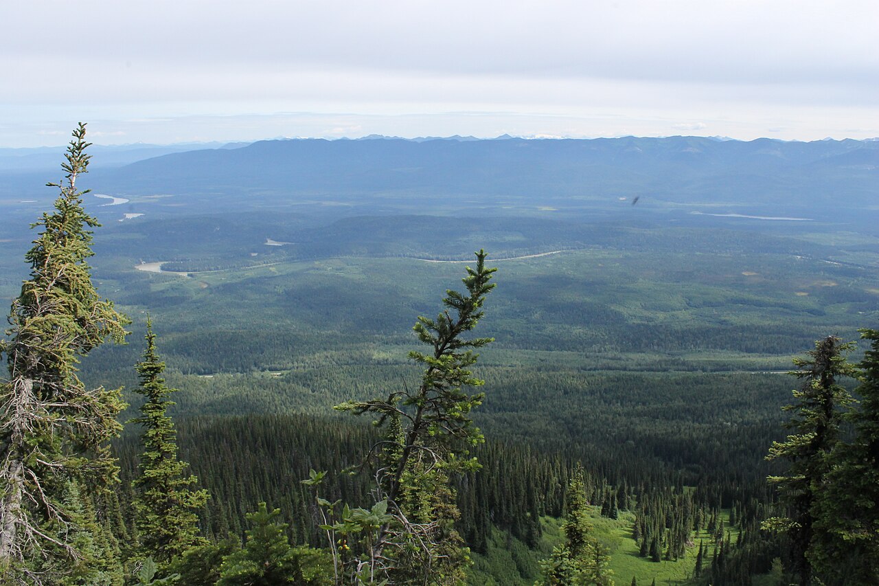 Photo: Newfoundlandguy · CC BY-SA 4.0Hikes · Upper Fraser & Sugarbowl
Sugarbowl Mountain
Steep north-slope climb reaches ridge and summit; Viking connector creates a longer traverse.
Hard / 13.4 km round trip / 1,059 m gainRead guide →- Hikes · Upper Fraser & Sugarbowl
Sugarbowl ridge
A steep forest climb reaches Sugarbowl’s open subalpine ridge, with a shorter turnaround than the summit outing. The upper ridge needs careful navigation when cloud hides the…
10 km round trip / Not established gainRead guide →