Monkman Pass: Hiking the Highway That Was Never Finished
A proposed route through the Rockies left an extraordinary story of volunteers, mountain travel and a road that never became the highway its supporters imagined.
A road imagined across the mountains
Look at a map of the Peace country and the Pacific coast and it is easy to understand the appeal of a shorter route through the Rockies. Getting a crop to market was not an abstract geographic problem. The length and cost of the journey could shape what farming in the Peace region could become.
Alex Monkman first promoted a railway, then a highway through the pass. The Monkman Pass Highway Association formed in 1936 to pursue the road.
Sources: 1
The work behind the memorial
In 1937 the trailblazing party included Alex Monkman, Carl Brooks, Ted Chambers and Shorty McGinnis. Behind them was a wider effort that built a road from Rio Grande to Kinuseo Falls. The Memorial Trail’s historical account describes volunteers working for meals, committing their labour to a route they hoped would change the economics of farming in the Peace.
Money and practical obstacles slowed the work. The Second World War ended the effort before it became a through-road. The walk follows the geography of an ambition.
One gesture made that purpose visible: a symbolic bag of grain was carried to Prince George. It was a small cargo with a large argument behind it. The mountains could be crossed; the question was whether a practical transport route would follow.
History appears in the names along the way
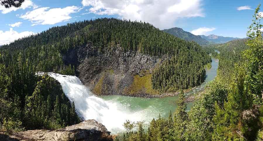
The Wolverine Nordic & Mountain Society identifies several Cascades waterfalls with members of the trailblazing crew, including Chambers, McGinnis, Monkman and Brooks. A list of names becomes more meaningful once you know that connection. The memorial is spread through a landscape rather than contained in a single plaque.
The walking itself also gives scale to the old proposal. The society describes forest, limestone ridge sections, a suspension bridge, waterfalls and the quartzite boulder field known as Hell’s Half Acre on the northern approach to Monkman Lake. These are reasons to visit in their own right. They also make the labour of pushing a route through the mountains easier to picture.
Sources: 3
The scale of the country
On the northern approach, the route toward Monkman Lake is about 25 kilometres one way. The waterfalls and lake therefore belong to a substantial backpacking trip, not a quick historical stroll. Beyond the lake, the full Memorial Trail continues into terrain that the local society describes as a wilderness route requiring advanced navigation.
That scale is part of the story’s appeal. A line drawn through a pass looks economical on paper. Underfoot it becomes rock, forest, river crossings, weather and the repeated work of moving supplies. A modern backpacker experiences only a small part of what the road crews faced, but the country puts the ambition into proportion.
Sources: 3
The road that remained an idea
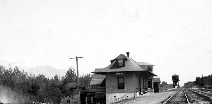
The unfinished route has left something more unusual than a ribbon of pavement. Its history is spread among names, old photographs and stretches of country that still require a serious journey. Chambers, McGinnis, Monkman and Brooks are also waterfall names, reminders of four people who tried to turn a proposed connection into a route others could follow.
Choose an outing that fits your experience and confirm its current access. The northern Cascades and lake trip and the full through-route are different commitments. Either way, the story gives the landscape another dimension: the highway was never finished, but the effort left a lasting mark on how people know this corner of the Rockies.
Explore the places in this story
Monkman Pass Memorial through-route
Historical route overview; current end-to-end feasibility needs direct confirmation.
Monkman Lake
Separate return backpacking outing from the northern trailhead.
Monkman Cascades
Separate destination and side-trail planning.
Sources and further reading
- Monkman Park (opens original source)BC Parks · Checked
- Monkman Pass Memorial Trail Hiking Route (opens original source)Tumbler Ridge News; text by Charles Helm, hosted by Town of Beaverlodge · Checked
- Monkman Cascades and Monkman Lake Hiking Route (opens original source)Wolverine Nordic & Mountain Society · Checked