A LOCAL FIELD GUIDE

Hiking around Prince George

Find a walk close to home, a waterfall, or a day in the mountains.

Places to go

31 to 38 of 38 places · 36 on the map

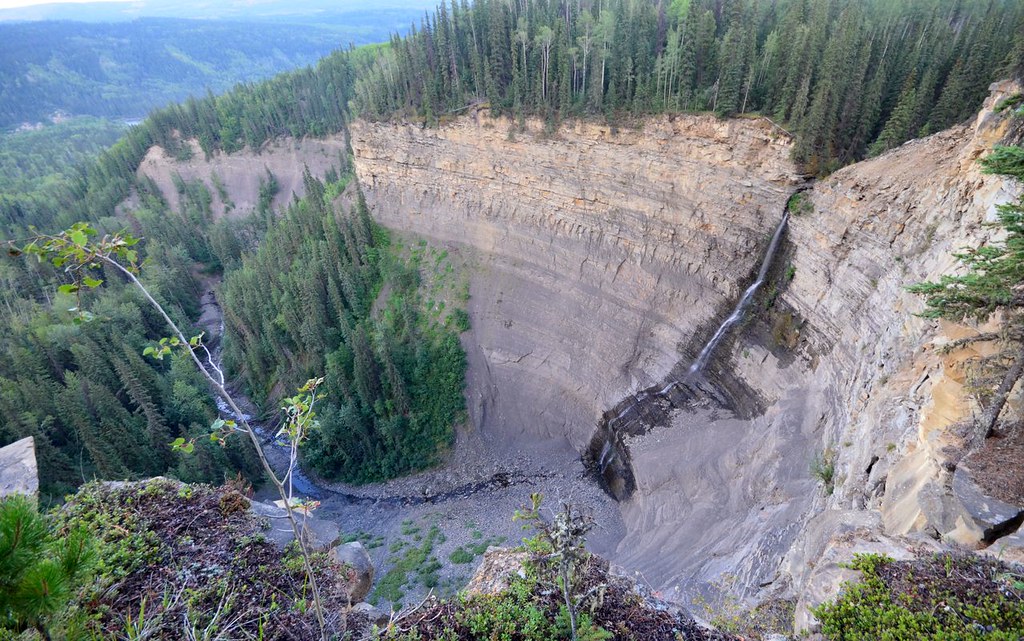
Bergeron Falls and the canyon below
Photo creditBergeron Falls - Tumbler Ridge, British Columbia, Canada. · Miles Green · CC BY 2.0 · Photographed Aug 26, 2014 · Provider resized the original for this download; no local edits. Display may crop the view.

Tumbler Ridge / Monkman / Peace Rockies

Bergeron Falls

Upper views and a longer circuit explore different parts of the canyon. Water crossings and cliff exposure make the circuit more demanding.

12 km loop450 m gain5–7 hours

Tumbler Ridge / Monkman / Peace Rockies

Quality Falls

Forest walk to upper Quality Creek waterfall, with a steeper final descent.

2.5 km round trip75 m gainUnder 1 hourfor fit hikers; allow longer for stops

Tumbler Ridge / Monkman / Peace Rockies

Kruger’s Flats

Walk the mostly level remains of the old Monkman Pass highway to a clearing with deteriorating cabins from a former mink ranch. Expect wet…

6 km round trip2 hours

Tumbler Ridge / Monkman / Peace Rockies

Murray Canyon Overlook

Forest approach reaches exposed slopes above the Murray River and follows the valley rim to a turnaround bench.

6.5 km round trip

Tumbler Ridge / Monkman / Peace Rockies

Tepee Falls

Creekside forest approach finishes with a viewpoint loop above the canyon.

6 km loopAllow 3 hours

Tumbler Ridge / Monkman / Peace Rockies

Long Lake

A short forest walk reaches a promontory beside narrow Long Lake, with marsh habitat toward its eastern end. This is a lakeside visit with a…

1 km round trip40 minutes

Tumbler Ridge / Monkman

Decent Camp

Official Monkman map marks camp at trail km 39; these are route-chainage values, not road distances.

39 km one way

Tumbler Ridge / Monkman / Peace Rockies

Wolverine Dinosaur Trail

A dinosaur-trackway visit for which the local recreation map directs visitors to arrange access through the museum.

1 km round trip1 hour