Not establishedCumulative ascent for this outing has not been established.
Walking time
Not published
Difficulty
Easyout-and-back
Map & elevation
Opening the map…
Partial elevation profile
Mapped portion · walking direction unconfirmed · 2.61 km
This chart covers only part of the route. It does not establish the full hike or a return journey.
Coverage and elevation sources
2.61 km along source section 1 of 1, in its mapped direction. Approximate 90 m terrain model along this mapped section. Separate sections are not joined. This chart does not measure total trail ascent or establish current access; use the guide’s published outing measurements.
Mapped named trail. Only separately mapped upper overlook sections are shown. The source approach way has an undated comment saying it was closed after logging and is omitted; this reference does not establish a currently open connection from the highway. Confirm current access before planning the hike. Line source (opens original source).
From Tumbler Ridge, follow Highway 52 north toward Dawson Creek for about 30 km. Park in the highway pullout on the left and locate the trail at its southern, Tumbler Ridge end. From Dawson Creek, use Highway 97 west to Highway 52, then continue about 70 km south to the pullout on the right.
Map position: 55.29047, -120.89556 · trailhead. WNMS publishes this exact coordinate pair in its Directions to Trailhead link. The RSTBC management point lies about 1 km west along the route and must not be presented as parking.
On the trail
Walk the original path for about 250 m, then join the old logging road.
Near kilometre 1, leave the road for the forest path. Reach the first rim bench and staircase around kilometre 1.75.
Continue about 1.5 km along the open valley rim to the final bench and viewpoint.
Full route notes
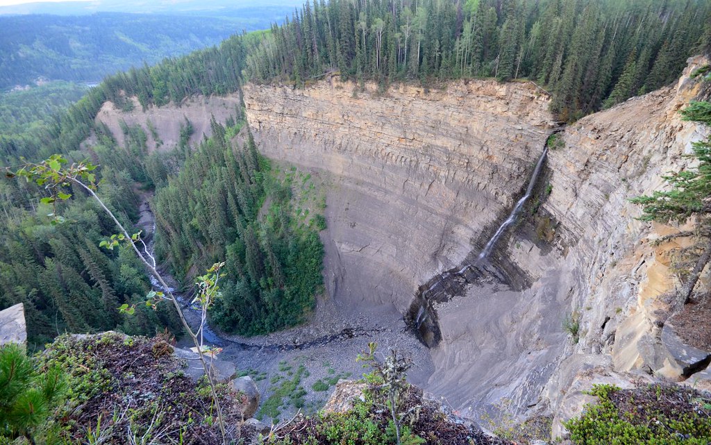
Follow the forest path for approximately 250 m, then the old logging-road section until the trail leaves it again near kilometre 1. Around 1.75 km, reach the valley rim and a rustic staircase leading to the first bench. Continue along the open slope for roughly another 1.5 km to the natural turnaround bench, with the Murray River more than 300 m below. The return follows the same line. The open traverse gives views of river terraces, side canyons and the surrounding foothills, but it also leaves the shelter of the forest; stay on the improved trail rather than descending the steep valley slopes.
The way back
Retrace the approach. The two outward stages total about 3.25 km, giving the published 6.5 km return; the river’s 300 m drop below the viewpoint is not hiking ascent.
Terrain: exposure · gravel.
Conditions & seasons
The south-facing slopes are warmer and drier than nearby forest but are exposed to strong winds. Summer wildflowers and spring/autumn raptor migration are seasonal features. Snow or ice can make the open traverse more difficult despite modest total climbing.
These are dated research notes. Open the trip planner for current available weather and advisory feeds; no alert found does not establish that a trail or road is open.
On-route camping permission has not been established for this outing. Check the relevant land manager before planning an overnight stay; a mapped lake, cabin or previous tent location does not confirm permission.
Photos of Murray Canyon Overlook
A photograph with confirmed reuse permission has not yet been added to this guide.
Original photo galleries
These galleries stay on their photographers’ original websites.
Descriptions are written for this guide from the linked evidence. Source review dates, published reports and field observations can differ. Photographs and route lines retain their own attribution and reuse terms.