Mapped portion · walking direction unconfirmed · 1.07 km
This chart covers only part of the route. It does not establish the full hike or a return journey.
Coverage and elevation sources
1.07 km along source section 1 of 1, in its mapped direction. Approximate 90 m terrain model along this mapped section. Separate sections are not joined. This chart does not measure total trail ascent or establish current access; use the guide’s published outing measurements.
The hosted map shows about 2.2 km return with a descent toward the falls. Creek-side scrambles and photographed pools are not automatically part of the maintained route.
Mapped named trail. Shows the named source trail. The full published outing, return journey and current on-the-ground alignment are not independently established by this line. Line source (opens original source).
Leave Tumbler Ridge on Highway 52 north toward Dawson Creek.
At about 6 km from Mackenzie Way, use the signed parking area on the left.
Parking: The signed summer clearing is on the left of Highway 52 north, 6 km from its Mackenzie Way junction. The path starts at the back of the clearing.
Full access notes
Take Highway 52 north from Tumbler Ridge toward Dawson Creek. About 6 km from the Mackenzie Way/Highway 52 junction, use the signed parking clearing on the left; the trail begins at the back of the clearing. The steward identifies a winter pullout on the opposite side of the highway for snowshoe access, so a winter visit may require a careful highway crossing.
Map position: 55.15607, -120.93961 · recreation project location. Source-published recreation project point; not verified parking or trailhead.
On the trail
Follow the forest path about 1 km to the upper waterfall viewpoint.
For the lower view, descend the established switchbacks and steep final section to creek level. Stay clear of the escarpment edge.
Full route notes
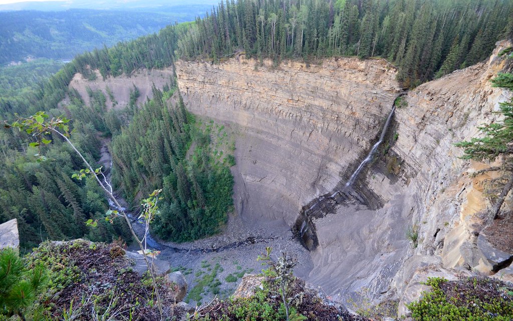
Follow the forest trail for approximately 1 km to the upper Quality Falls viewpoint. The creek drops about 7 m over a sandstone ledge. For a closer view, the trail descends by switchbacks to creek level; return up the same path rather than treating downstream animal tracks as a signed loop. Several other waterfalls and a deep canyon lie downstream beyond the standard destination. Stay clear of the escarpment edge and do not assume the creek can safely be followed after heavy rain.
The way back
Climb the same switchbacks and return by the forest path. Downstream waterfalls and canyon exploration are outside the standard 2.5 km return outing.
Distance and elevation source notes
A firsthand October 2026 guide publishes 75 m gain for a 2.5 km return. The geopark independently confirms the 2.5 km outing. Stopping at the upper viewpoint changes the extent; downstream exploration is excluded.
Conditions & seasons
The trail is also visited on snowshoes using the alternate winter parking. Summer storms can raise the creek quickly, and ice or wet rock changes the lower viewpoint approach. Birdwatching is another reason to pause in the wetter forest sections.
Winter route
The steward identifies a winter pullout directly opposite the summer trailhead, on the right side of the highway when approaching from Tumbler Ridge. This means crossing the highway to reach the trail.
These are dated research notes. Open the trip planner for current available weather and advisory feeds; no alert found does not establish that a trail or road is open.
On-route camping permission has not been established for this outing. Check the relevant land manager before planning an overnight stay; a mapped lake, cabin or previous tent location does not confirm permission.
Photos of Quality Falls
A photograph with confirmed reuse permission has not yet been added to this guide.
Original photo galleries
These galleries stay on their photographers’ original websites.
Descriptions are written for this guide from the linked evidence. Source review dates, published reports and field observations can differ. Photographs and route lines retain their own attribution and reuse terms.