Mackenzie
Dick Dauphinee Trail
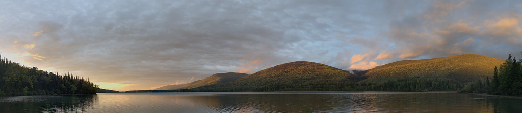
A short 1.5 km loop in John Dahl Regional Park, with forest walking and viewpoints toward Morfee Lake. It forms part of a connected park network…
1.5 km · loop
A LOCAL FIELD GUIDE
Find a walk close to home, a waterfall, or a day in the mountains.
Mackenzie
A short 1.5 km loop in John Dahl Regional Park, with forest walking and viewpoints toward Morfee Lake. It forms part of a connected park network…
Mackenzie
A substantial forest loop circles Morfee Lake, with connections to beaches, the narrows and a separate Morfee Falls branch. It is a longer walk…
Mackenzie
A branch from the Morfee Lake Perimeter Trail reaches a creekside view of Morfee Falls. The official walking endpoint is a view from the creek,…
Tumbler Ridge / Monkman / Peace Rockies
Old exploration roads lead into the alpine, where a ridge walk crosses successive rises above the Kinuseo valley. Return by the same route and…
Chetwynd / Hasler
A former exploration road leads to a steep ridge climb and a summit above the Hasler road country. It is an unmaintained mountain route where…
Mackenzie
A lakeshore loop close to Mackenzie offers a gentle walk and picnic setting. It is also used for winter recreation, but the walking trail and…
Pine Pass
A very steep route near Azouzetta Lake climbs an avalanche berm and gully to an open ridge. It is a different access and objective from the…
Pine Pass
A sustained steep climb above Highway 97 reaches alpine ridges, lakes and several different summit objectives. The first high point, lake basin…
Chetwynd / Hasler
A seismic-line ascent reaches alpine lake country below Mount Stephenson. This guide’s main objective is the lake approach; a summit or ridge…
McBride · Dore River valley
Creek-following trail reaches cabin; lake and waterfall extensions are additional outings.