Bijoux Falls
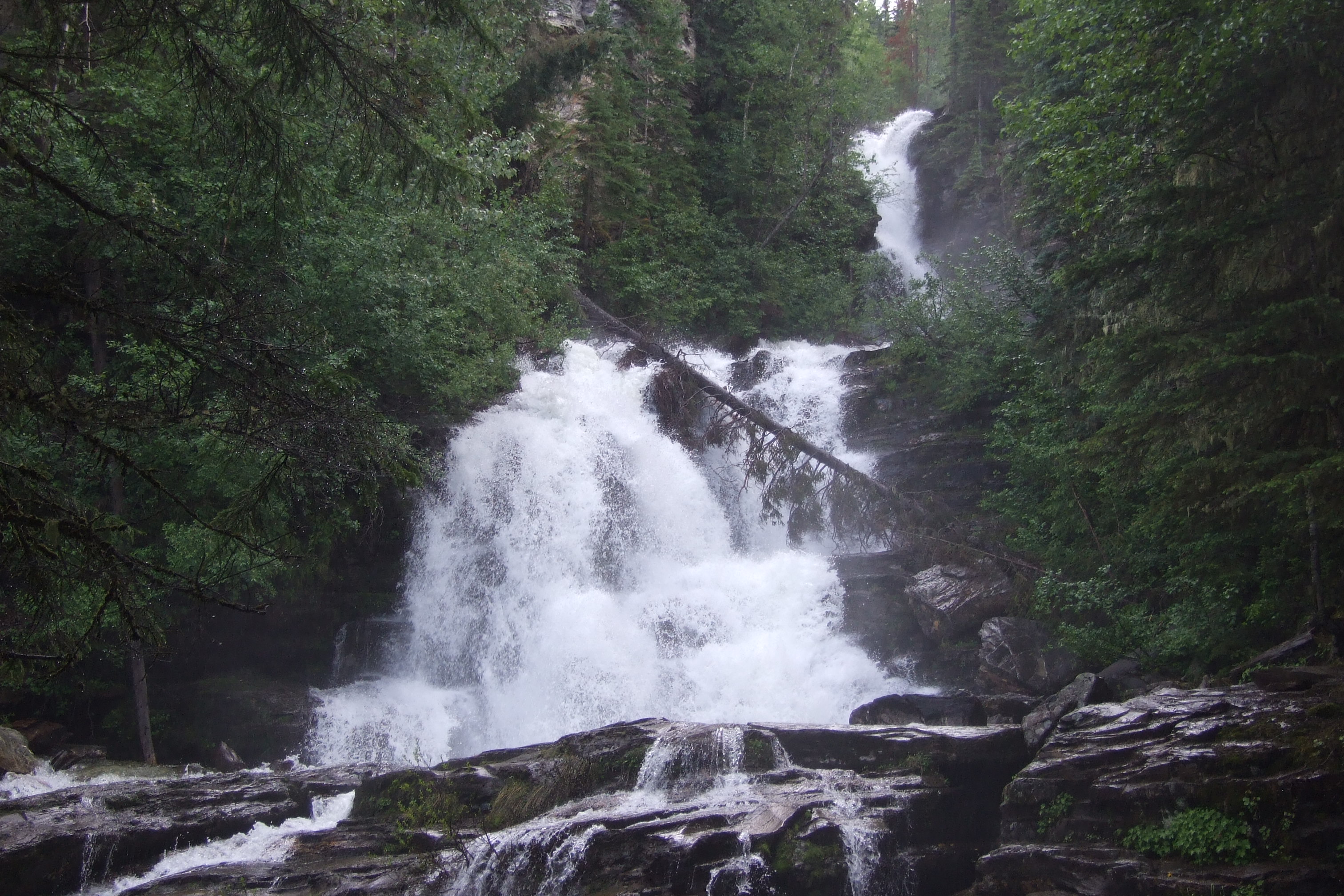
A short roadside stop in Pine Pass provides a fenced view of a cascading waterfall. It is a day-use waterfall visit rather than a developed hiking circuit.
Sources reviewed . This is a research date, not a trail inspection.
- Distance
- Not publishedTrip basis unconfirmed
- Elevation gain
- Not establishedCumulative ascent for this outing has not been established.
- Walking time
- Not published
- Difficulty
- Not rated
Map & elevation
Elevation profile
Full round trip · approximately 0.1 km mapped
Approximate terrain elevation. Mapped distance may differ from the published hike distance.
Map and elevation sources
Approximate ground elevation from a 90 m terrain model. Distance follows the mapped itinerary and may differ from published walking distance. This is a terrain-model profile, not a surveyed measurement. Any ascent total is identified separately with its own source or estimation method.
BC Parks describes viewing the waterfall from the day-use area and advises staying behind the barrier; it does not promote a hiking trail up the falls. The retained OSM path has an exact endpoint at the parking service-road terminus and the other at a tagged viewpoint. Its stored coordinates run viewpoint-to-parking, so this itinerary explicitly reverses them and retraces the short path for the return. An unrelated southward path branch is excluded.
Route source 1Route source 2Route source 3Route source 4Copernicus GLO-90 terrain elevations via Open-Meteo (CC BY4.0); linework: Open Database License (ODbL) 1.0 · checked 2026-10-18 · CC BY4.0 elevation data; Open Database License (ODbL) 1.0 linework. Copernicus DEM 2021 GLO-90 via Open-Meteo. Linework source: https://www.openstreetmap.org/way/1225336178. Sampled and rounded for display.
Complete mapped outing from Path entrance at day-use parking, including the return on the same route. Line source (opens original source).
Getting there & parking
The park access is directly off Highway 97, approximately 44 km north of McLeod Lake. From Prince George the tourism brochure places the parking on the left after about 187.6 km of northbound travel. Use the signed park entrance and parking area rather than stopping on the highway shoulder; check turning traffic carefully.
Map position: 55.31028, -122.67361 · named falls destination. BC Gazetteer: Bijoux Falls | Falls | 55 18 36 N | 122 40 24 W | WGS84 | mapsheet 93O/7 Official named-feature location, not parking or a verified route start. This point supports regional orientation and area forecasts; road directions and distance-to-trailhead must use a separately verified access point.
On the trail
Walk from the day-use parking to the fenced waterfall viewing area and remain behind the fence.
Full route notes
Walk from the day-use area to the fenced waterfall-viewing area and remain behind the barrier. BC Parks says there are no developed hiking trails in the park, so short distance figures in other guides should be understood as a brief waterfall visit, not a surveyed loop or a route up beside the cascade. The rest area provides a convenient pause on the Pine Pass drive. Keep dogs leashed, avoid climbing around the fence for a closer photograph and leave wildlife, including the resident jays, unfed.
Terrain: unmaintained.
Conditions & seasons
Open but not maintained in winter; snow can prevent access.
Winter route
The park is open but is not maintained in winter and may become inaccessible.
These are dated research notes. Open the trip planner for current available weather and advisory feeds; no alert found does not establish that a trail or road is open.
Camping & overnight plans
Day use only; camping and campfires are not permitted.
Photos of Bijoux Falls
Take this guide with you
Choose a trip pack or an available individual sheet for your map case.
Sources, dates & research notes
Descriptions are written for this guide from the linked evidence. Source review dates, published reports and field observations can differ. Photographs and route lines retain their own attribution and reuse terms.
- https://bcparks.ca/bijoux-falls-park/ (opens original source)
- https://catalogue.data.gov.bc.ca/dataset/bc-geographical-names (opens original source)
- https://catalogue.data.gov.bc.ca/dataset/d92224ee-03ef-4904-be53-b677d8e01ac4/resource/69738aa8-2cc0-4975-aec6-4dc2e30990bf/download/bc-gazetteer-2026-08-12.csv (opens original source)
- https://tourismpg.com/wp-content/uploads/2025/05/36970-PG-Waterfalls_Brochure-1.pdf (opens original source)
OpenStreetMap line references (3)
These contributor-mapped features support the map geometry. They are separate from the written access and route sources.
Details still being researched
- Total route elevation gain not verified; no substitution from summit altitude or waterfall height.
- No itinerary-specific measured distance verified.
Nearby and related guides
- Hikes · Pine Pass, Chetwynd & Peace
Murray Range
A very steep route near Azouzetta Lake climbs an avalanche berm and gully to an open ridge. It is a different access and objective from the better-known Mount Murray route farther…
4.8 km round trip / 870 m gainRead guide → - Hikes · Pine Pass, Chetwynd & Peace
Mount Murray (Pine Pass)
A sustained steep climb above Highway 97 reaches alpine ridges, lakes and several different summit objectives. The first high point, lake basin and main Mount Murray summit must…
Hard / 12 km · trip basis unconfirmed / Not established gainRead guide → - Viewpoints · Pine Pass, Chetwynd & Peace
Solitude Mountain
A strenuous extension above the Heart Lake viewpoints reaches the Solitude Mountain area. The lower path is easier to identify than the upper route, where brush and indistinct…
Hard / 10.07 km · trip basis unconfirmed / Not established gainRead guide → - Viewpoints · Pine Pass, Chetwynd & Peace
Mountain Creek Canyon Overlook
A steep forest climb from Heart Lake reaches two viewpoints over Mountain Creek. This is the shorter overlook outing; continuing toward Solitude Mountain is a separate, much less…
3.8 km round trip / 470 m gainRead guide → - Camping · Pine Pass, Chetwynd & Peace
Heart Lake campground
A user-maintained lakeside campground in Pine Le Moray Park, useful as a base for a quiet lake stay or a separately planned steep mountain outing. Its services differ from a fully…
Camping destination · access & overnight informationRead guide → - Hikes · Pine Pass, Chetwynd & Peace
Le Moray Lakes / Donkey Trail
A remote restored horse-trail corridor reaches upper meadows and the Lemoray lakes. Fallen trees, devil’s club and limited communication make this a backcountry route requiring…
HardRead guide →