Cabin approach offers further alpine day hikes; reservation arrangements must be checked with the operator.
Sources reviewed . This is a research date, not a trail inspection.
Check access before you leave
Dore River road access: closed bridge; reopening not verified
The provincial page updated October 8, 2026 still lists the Dore River Branch 1 bridge at kilometre 2.1 as closed with a zero-tonne load rating. The same page announced replacement work for the week of August 17 and expected two to three weeks of construction, but does not confirm reopening. These overlapping notices leave the current outcome unresolved. Confirm reopening with the road authority before relying on access beyond this bridge.
Approx. 690 mTerrain-model estimate; not a surveyed measurement.
Walking time
6 - 8 hours
Difficulty
HardThere and Back
How the elevation gain was established
Outing: out-and-back outing from Published 2026 Eagle Valley trip start on the old-road approach to Eagle Valley Cabin and back; 17.81 km along the mapped itinerary
Copernicus DEM 2021 GLO-90 via Open-Meteo (90 m resolution). v7-smoothed-ascent-1: interpolate retained terrain samples at 100 m spacing; apply one triangular 1:2:1 smoothing pass over ±100 m; preserve start, finish and documented turnaround heights; sum uphill excursions with a 5 m reversal threshold; round to nearest 10 m.
Approximate terrain-model ascent, not a field or GPS measurement. Coarse cells and smoothing can miss small climbs, switchbacks, structures and sharp terrain. Processing sensitivity is not a statistical confidence interval.
StartPublished 2026 Eagle Valley trip start on the old-road approach8.9 km · turn aroundEagle Valley Cabin17.8 km · back at startPublished 2026 Eagle Valley trip start on the old-road approach
Approximate terrain elevation. Mapped distance may differ from the published hike distance.
Map and elevation sources
Approximate ground elevation from a 90 m terrain model. Distance follows the mapped itinerary and may differ from published walking distance. This is a terrain-model profile, not a surveyed measurement. Any ascent total is identified separately with its own source or estimation method.
The local tourism description identifies roughly 3 km on a deactivated logging road before the valley footpath, followed by approximately 6 km to the cabin. The former map contained only that footpath. Fresh OSM data retain a separately named Eagle Valley Trail road segment with an exact shared endpoint at the footpath start. Its vertex 1 lies about 9 m from the independently published EagleValley2026 trip-start coordinate, and the cabin endpoint exactly touches the named alpine-hut building. The road walk and footpath are therefore one continuous cabin outing with a retraced return. The track-start fact does not establish the exact porcupine enclosure or certify current vehicle access. Glacier travel beyond the cabin is excluded.
Complete mapped outing from Published 2026 Eagle Valley trip start on the old-road approach, including the return on the same route. Line source (opens original source).
Getting there & parking
The Dore River bridge at road kilometre 2.1 remains listed as closed; the road authority has not confirmed reopening. These approach instructions are conditional on lawful, passable road access.
Leave Highway 16 for Dore River Road about 5 km west of McBride.
At the main junction about 6 km along the forest-road approach, turn left onto South Dore toward Eagle Valley. Continue about 13 km to the trailhead enclosure.
Parking: The local tourism guide locates a porcupine-protection enclosure at the road-end trailhead. The Dore River bridge at road kilometre 2.1 remains listed as closed; the road authority has not confirmed reopening. These approach instructions are conditional on lawful, passable road access.
Full access notes
Access alert: the Dore River bridge at road kilometre 2.1 is listed as closed, and a reopening has not been verified. Confirm the road authority’s current status before using the approach below. Turn off Highway 16 onto Dore River Road about 5 km west of McBride. Follow the Dore forest-road approach to the junction around kilometre 6 in the current tourism description, then take the left branch, South Dore, signed toward Eagle Valley. Continue approximately 13 km to the trailhead’s porcupine enclosure. The older Green Guide describes a final signed left branch and a short approach across the Dore River before parking. Confirm the bridge, road and final turn with the Ozalenka Alpine Club before the trip.
Map position: 53.17346, -120.35522 · start point of published trip track (parking unverified). Embedded trip-map feature 'EagleValley2026': first recorded coordinate [-120.355215, 53.173461].
Point extracted from the original public trip map. A track start is evidence of where recording began, not certification of parking, legal access, road suitability or the complete route.
On the trail
Walk approximately 3 km along the deactivated logging road.
Continue up the creek valley for about another 6 km to Eagle Valley Cabin. Slippery ground and old avalanche debris can interrupt the approach.
Full route notes
Start along a deactivated logging road for approximately 3 km. Beyond that road section, the route follows the creek valley for roughly another 6 km to the cabin, near the end of an old glacier valley. Wet or icy sections can be slippery, and the local tourism guide warns that large avalanche deposits can remain across the approach in some years. The cabin is about 9 km one way from the trailhead; reaching the glacier beyond it is an additional excursion. Do not treat a cabin hike as authorization or preparation for glacier travel.
The way back
Retrace the valley and logging-road approach. The cabin trip is about 18 km return; travel beyond the cabin toward ice is additional.
Terrain: alpine.
Distance and elevation source notes
9 km to cabin
550 m
The cabin is approximately 9 km one way, or 18 km return.
The previously imported 550 m ascent is not present in the exact retained club page or McBride tourism guide. Total ascent for the cabin outing remains unverified.
Conditions & seasons
The older local guide specifically warns of avalanche exposure in winter and spring. Avalanche debris can still obstruct the route later in the year. Winter travel therefore needs a separate snow and avalanche plan, not merely the summer directions followed on snow.
These are dated research notes. Open the trip planner for current available weather and advisory feeds; no alert found does not establish that a trail or road is open.
Reserve in advance through Ozalenka Alpine Club. Caledonia Ramblers lists 250-569-2596 and a 9 km approach to the cabin. Confirm capacity, fees and current access directly with the club.
Reserve the cabin through the Ozalenka Alpine Club before setting out. The published route identifies the cabin as the overnight facility; it does not establish maintained tent pads or unrestricted camping at every point in the valley.
A photograph with confirmed reuse permission has not yet been added to this guide.
Surrounding area and context
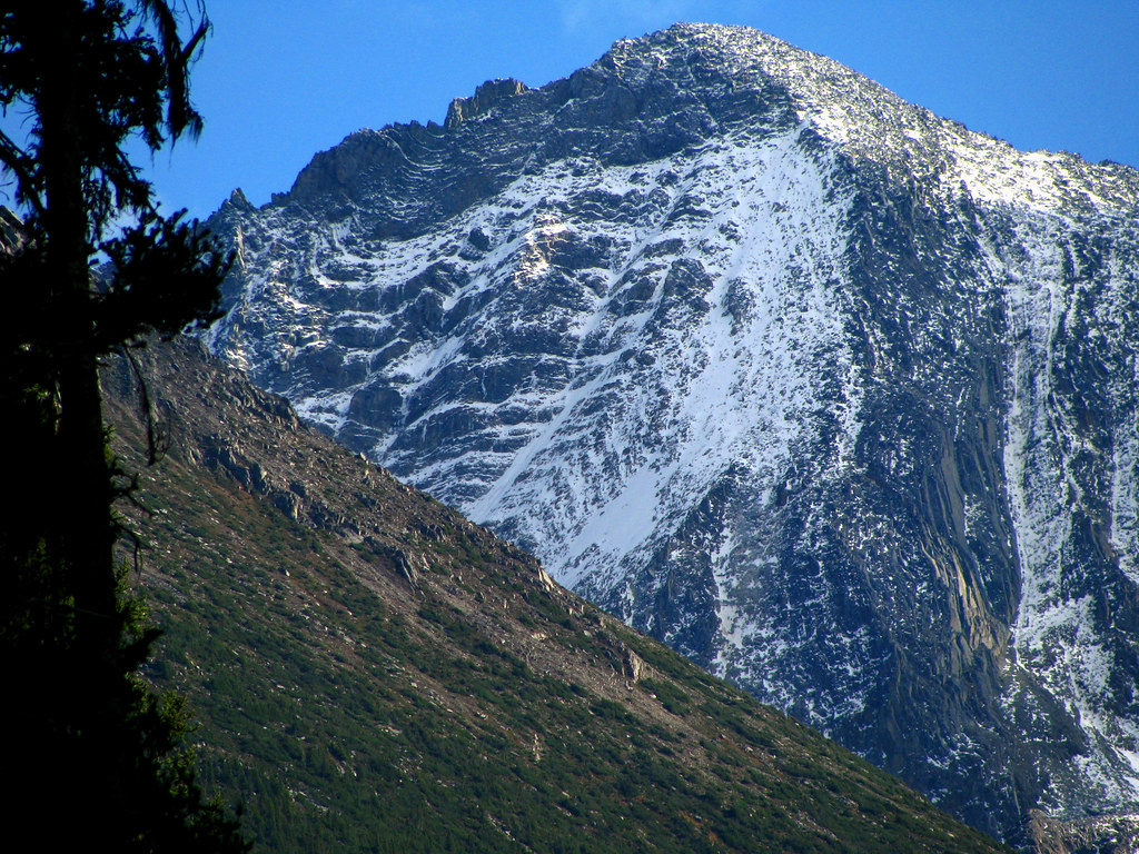
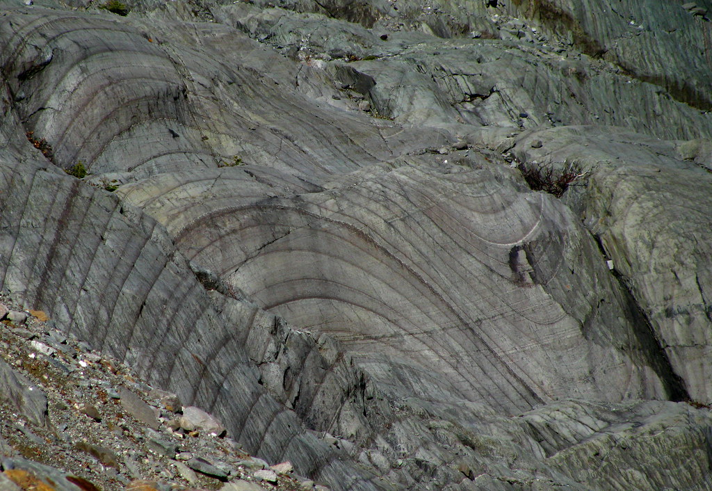
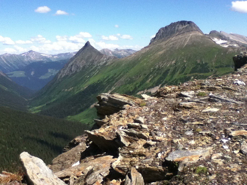
These photographs provide context; they do not establish the appearance of this selected route or facility.
Mountains at the north end of Eagle Valley, west of McBride, 8 October 2012. This landscape shows the cabin outing’s valley setting; the cabin itself is not pictured.Cariboo Mountains (opens original source) · Dru! · CC BY-NC 2.0 (opens original source) · 2012-10-08. Source display image downloaded without local content edits. Display may crop; adaptations retain the stated image licence. · Noncommercial only; obtain a commercial licence or replace before commercial use.Folded sandstone in Eagle Valley near McBride, 7 October 2012. A geological detail from the valley, not a photograph of cabin facilities or a marked hiking path.Syncline and Anticline (opens original source) · Dru! · CC BY-NC 2.0 (opens original source) · 2012-10-07. Source display image downloaded without local content edits. Display may crop; adaptations retain the stated image licence. · Noncommercial only; obtain a commercial licence or replace before commercial use.
Original photo galleries
These galleries stay on their photographers’ original websites.
Descriptions are written for this guide from the linked evidence. Source review dates, published reports and field observations can differ. Photographs and route lines retain their own attribution and reuse terms.
Reliable cabin-route ascent remains unresolved. A secondary track gives 2,885 m with minimum elevation 0 m, signalling corrupt or mixed geometry; that number is rejected.