Lucille Mountain
An alpine approach above McBride that passes a snowmobile cabin before continuing to a broad summit with Robson Valley views.
Sources reviewed . This is a research date, not a trail inspection.
The locations GPX contains sourced points with their recorded roles. It contains no trail track or connecting route.
- Distance
- 2.7 kmRoute segment
- Elevation gain
- Not establishedCumulative ascent for this outing has not been established.
- Walking time
- Not published
- Difficulty
- Moderate
Map & elevation
Elevation profile
A full-route elevation profile is not available yet.
A reusable trail line has not yet been verified for this outing. Any location pin shows the published location described above; it does not draw the hike or establish a navigable approach.
Getting there & parking
From McBride’s visitor centre, follow First Avenue east for about 650 m, then turn right onto Sansom Road.
After about 2.2 km on Sansom Road, turn left onto Lucille Mountain Forest Road. The lower lot is about 650 m up this road.
For the upper approach, take the right fork at the 4.5 km junction and continue to the meadow kiosk only if road and vehicle conditions permit.
Parking: Tourism describes a lower lot 650 m up Lucille Mountain Forest Road and upper parking at an alpine meadow kiosk. The upper start requires four-wheel drive.
Full access notes
From McBride Visitor Centre, travel east along First Avenue for about 650 m, turn right onto Sansom Road, and continue about 2.2 km. Turn left onto Lucille Mountain Forest Road; the lower parking area is roughly 650 m farther on. For the upper summer approach, follow the mountain road and take the right branch at the 4.5 km junction. McBride Tourism describes four-wheel-drive access to the meadow with a small information kiosk. The older guide warns that the road above a clearing around kilometre 7.4 becomes particularly steep and rough. Park earlier if necessary and add the remaining road walk to your outing; lower and upper parking produce very different distances.
Modeled one-way driving time from Prince George City Hall, using mapped road speeds. Forest-road sections can take substantially longer: surface, clearance, radio procedures, gates, washouts, plowing, and legal access are not verified by the router. No live traffic or invented forest-road multiplier is included. Allow extra time and check the dated access notes.
Map position: 53.27455, -120.25394 · source-published trailhead / parking waypoint. Embedded trip-map feature 'Lower 4x4 Parking lot': point [-120.253944, 53.274555]. Named access waypoint extracted from the original public trip map. Current road/parking conditions and legal access still require checking.
- Published parking · 53.27455, -120.25394. Named point on source trip map; position and feature type retained as factual observations. Location source (opens original source)
- Trail access · 53.26578, -120.25510. Named point on source trip map; position and feature type retained as factual observations. Location source (opens original source)
On the trail
From the upper meadow parking, follow the mountain approach past the winter snowmobile cabin.
The tourism guide places the peak approximately 2.7 km beyond the cabin; return on the same approach.
Full route notes
From the upper meadow, continue on foot through the subalpine toward the winter snowmobile cabin. The older guide places the cabin about 900 m beyond the meadow; McBride Tourism then gives about 2.7 km from the cabin to the peak. Continue through the open alpine toward the summit for views over the Robson Valley, the Rocky Mountains and, in clear weather, Mount Robson. Return along the same approach to the vehicle. This is an exposed alpine outing above the forest-road access, and the published sources do not establish a single fixed distance that applies to every possible parking point.
The way back
Retrace to the chosen parking. The 2.7 km figure starts at the cabin and is not the whole return trip from either parking lot.
Conditions & seasons
Summer access uses the forest road and a walking route through the meadows. In winter this is an established snowmobiling area with a cabin and groomed access; the summer driving instructions do not describe a winter road suitable for ordinary vehicles.
These are dated research notes. Open the trip planner for current available weather and advisory feeds; no alert found does not establish that a trail or road is open.
Camping & overnight plans
A winter snowmobile cabin is described along the route, but the sources reviewed do not establish public overnight booking rights or a serviced summer tent site. Do not count on the cabin for accommodation without confirming the operator’s current rules.
Photos of Lucille Mountain
A photograph with confirmed reuse permission has not yet been added to this guide.
Surrounding area and context
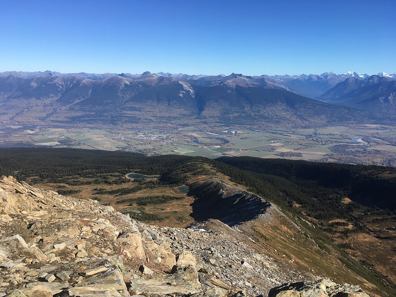
These photographs provide context; they do not establish the appearance of this selected route or facility.
Original photo galleries
These galleries stay on their photographers’ original websites.
- Lucille Mountain Trail in McBride, BC — photographs and trip report (opens original source) · Hiking Prince George
Take this guide with you
Choose a trip pack or an available individual sheet for your map case.
Sources, dates & research notes
Descriptions are written for this guide from the linked evidence. Source review dates, published reports and field observations can differ. Photographs and route lines retain their own attribution and reuse terms.
- https://mcbridetourism.ca/adventure-outdoor/hiking/ (opens original source)
- https://hiking.princegeorge.tech/lucille-mountain-trail-in-mcbride-bc/ (opens original source)
- https://routing.openstreetmap.de/about.html (opens original source)
- https://mcbridetourism.ca/wp-content/uploads/McBrides-Green-Guide.pdf (opens original source)
Details still being researched
- Whole hiking itinerary length/gain and current 4WD road condition need confirmation.
Nearby and related guides
- Hikes · McBride & Robson Valley
Bell Mountain
Old road leads into alpine meadows; Little Bell and Big Bell are separate objectives beyond the campsite.
Moderate / 8-12 kms from campsite depending on destinationRead guide → - Hikes · McBride & Robson Valley
Horseshoe Lake
A short McBride outing to an abandoned Fraser River channel, with wetland birdwatching and a gazebo at the lake.
Easy / 2.6 km round tripRead guide → - Hikes · McBride & Robson Valley
Bluff / Connector / Outrun
A lower-mountain loop above McBride, using shared trails with viewpoints across town and the Cariboo Mountains.
Easy / 5 km loopRead guide → - Hikes · McBride & Robson Valley
McBride Mountain Trails
A multiuse trail network on the lower slopes of McBride Peak, with easy viewpoints and steeper hiking and mountain-bike routes.
ModerateRead guide →  Photo: Jim Swanson · CC BY 2.0Hikes · McBride & Robson Valley
McBride Peak
Alpine walks include McBride Peak and longer ridges toward Teare Mountain. High road access changes hike length.
Moderate / 4 km round trip / 450 m gainRead guide →- Hikes · McBride & Robson Valley
Paradise Ridge
Ridge and Mount Munroe are separate objectives; detailed route description absent.
Hard / 16 km round trip / Not established gainRead guide →