Sources reviewed . This is a research date, not a trail inspection.
Check access before you leave
Fang approach closed after rockslide
BC Parks closed the Fang Trail following rockfall and debris. The notice began June 19, 2026 and was updated June 22; it gives no reopening date. The restriction concerns this approach, not every route through Evanoff Park.
Not establishedCumulative ascent for this outing has not been established.
Walking time
Not published
Difficulty
Not rated
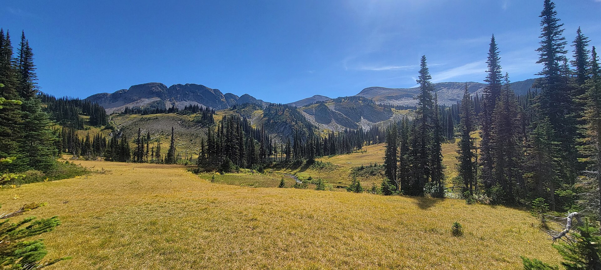
Subalpine meadow on the Fang trail in Evanoff Provincial Park, 2 September 2023. This photograph predates the 2026 trail closure.EvanoffPark3.jpg (opens original source) · Azubryan · CC BY-SA 4.0 (opens original source) · 2023-09-02. Provider resized the original for this download; no local edits. Display may crop the view. Adaptations retain the image licence.
Map & elevation
Opening the map…
Partial elevation profile
Mapped portion · walking direction unconfirmed · 4.04 km
This chart covers only part of the route. It does not establish the full hike or a return journey.
Coverage and elevation sources
4.04 km along source section 1 of 1, in its mapped direction. Approximate 90 m terrain model along this mapped section. Separate sections are not joined. This chart does not measure total trail ascent or establish current access; use the guide’s published outing measurements.
Historical Fang approach — currently closed. Historical Fang lake-basin approach only: BC Parks has closed this trail after a June 2026 rockslide. The line ends near the upper basin and excludes the summit and crossover. Endpoint differences from the official map remain; no new connectors or reopening claim are added. Line source (opens original source).
A BC Parks rockslide advisory closes the Fang Trail until further notice; confirm reopening before using this historical approach. From Highway 16 about 18.5 km east of Prince George, follow Upper Fraser Road approximately 60 km toward the Fraser crossing. Cross the river, then use Church FSR and the Longworth approach to reach Pass Lake FSR. Around kilometre 41 on Pass Lake FSR, roughly 3.4 km beyond the north end of Pass Lake, turn right onto the old track about 100 m west of the Pass Creek bridge. Parking is described approximately 500 m along this track. These road distances and the parking approach have not been checked against current conditions.
Map position: 54.11462, -121.37415 · published route endpoint near road access. Official KMZ Fang Lower line first coordinate: -121.3741464218476,54.11462250175928.
This is the lower endpoint of BC Parks mapped Fang route, not a separately labelled parking waypoint. Road access and a suitable parking location must be checked.
On the trail
The historical Fang approach follows the stream up a steep valley and through a notch between cliffs into the upper basin and its lakes. Stream crossings and wet, slippery sections form part of the route. This listing describes the lake/basin trail, not an ascent of Fang’s summit or a caving trip. BC Parks warns of an overgrown deep fissure near the trail and hazardous caves suited only to experienced cavers. The June 2026 rockslide closure applies to the approach, so a later visitor trip report is not proof that the trail is officially open.
The current rockslide closure must be resolved before an outing in any season. Winter adds avalanche exposure and snow can hide fissures; the summer lake route is not a verified winter alternative.
Grizzly activity in Evanoff Park
A park notice updated April 28, 2026 identifies regular grizzly activity, including family groups. BC Parks advises travelling together, making noise and carrying bear spray. This notice is not a trail closure.
BC Parks retains a bat-protection notice for caves. Consult its decontamination guidance before entering; equipment previously used east of the Rockies should not be brought into B.C. caves. The advisory is longstanding, not a new 2026 observation.
These are dated research notes. Open the trip planner for current available weather and advisory feeds; no alert found does not establish that a trail or road is open.
No current designated tent pads or serviced campsite were confirmed on the Fang approach. The presence of lakes and caves does not provide an authorized overnight facility, and the trail closure currently prevents planning normal access through this route.
Photos of Fang Trail
Subalpine meadow on the Fang trail in Evanoff Provincial Park, 2 September 2023. This photograph predates the 2026 trail closure.EvanoffPark3.jpg (opens original source) · Azubryan · CC BY-SA 4.0 (opens original source) · 2023-09-02. Provider resized the original for this download; no local edits. Display may crop the view. Adaptations retain the image licence.
Take this guide with you
Choose a trip pack or an available individual sheet for your map case.
Descriptions are written for this guide from the linked evidence. Source review dates, published reports and field observations can differ. Photographs and route lines retain their own attribution and reuse terms.