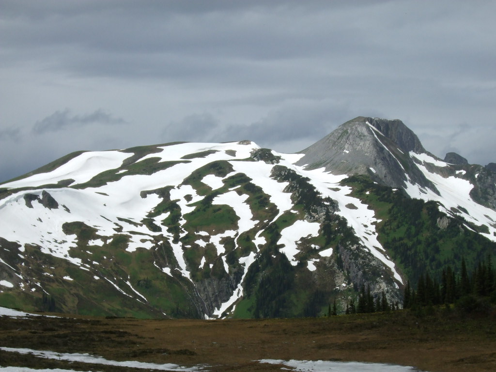
A steep forest approach in the McGregor Mountains reaches a reserved backcountry cabin in open meadows above Pass Lake. Summer-road and winter approaches are distinct, and continuing to the surrounding ridges makes a longer trip than reaching the cabin.
Sources reviewed . This is a research date, not a trail inspection.
See time notesOperator estimates 2–6 hours in summer and 4–8 hours in winter to the cabin; return time additional
Difficulty
HardThere and Back
Map & elevation
Opening the map…
Elevation profile
A full-route elevation profile is not available yet. The mapped paths have not been verified as one continuous outing.
Choose a specific route where available. Individual map fragments are not shown as separate hike stages.
More maps & trail files
AllTrails map
Farm Cabin and summit outing on AllTrails
This roughly 15.1 km return continues beyond the cabin toward the summit. It is longer than the approximately 10 km cabin trip; use the cabin operator’s booking and access rules.
Mapped named trail sections. The named Farm Cabin/Pass Lake corridor is shown. It does not establish a full cabin itinerary or overnight permission. Line source (opens original source).
Getting there & parking
Approach through the Giscome–Upper Fraser corridor and Pass Lake Forest Service Road northeast of Prince George. The reviewed text does not provide every forest-road junction, so obtain the steward’s current map and a suitable road-navigation plan before leaving the main road. PGBRS publishes the summer start at 54.114072, -121.413516; it can also serve winter outings when Pass Lake FSR is plowed. The separate winter start is 54.090532, -121.509354, used particularly when that road is not plowed. Do not route to the cabin coordinate as a vehicle destination.
The October 6, 2026 steward update had not confirmed Pass Lake plowing for winter 2026–27. That uncertainty changes both where a vehicle can stop and how much travel remains on foot or skis. Keep road access clear and verify the intended start for the actual season.
Estimated drive from Prince George: 2 hr 59 min · 121.3 km. Modeled one-way driving time from Prince George City Hall, using mapped road speeds. Forest-road sections can take substantially longer: surface, clearance, radio procedures, gates, washouts, plowing, and legal access are not verified by the router. No live traffic or invented forest-road multiplier is included. Allow extra time and check the dated access notes. Seasonal access notes apply; this estimate does not establish plowing or winter road access.
Map position: 54.11381, -121.41429 · source-published trailhead / parking waypoint. Embedded trip-map feature 'Trailhead': point [-121.414289, 54.113811].
Named access waypoint extracted from the original public trip map. Current road/parking conditions and legal access still require checking.
Trail access · 54.11381, -121.41429. Named point on source trip map; position and feature type retained as factual observations. Location source (opens original source)
On the trail
From the documented summer start, climb the sustained forest route toward the subalpine meadow and cabin. The club describes steep, brushy sections where the tread can be hard to see and slippery when wet. PGBRS lists the cabin approach as approximately 5 km each way; the club’s 10.4 km cabin outing and 14 km ridge outing are separate published scopes. An illustrated trip report also includes a longer 17 km exploration, which should not replace the shorter cabin distance.
The transition into the meadow is an important navigation point. Under winter snow, PGBRS warns that the last section may show no trail at all; identify the cabin and the return line with suitable navigation rather than assuming existing tracks will lead there. Its published cabin location is 54.118642, -121.468619. This is avalanche terrain in winter, and reaching the hut may require digging out its entrance. Allow for that work before dark and do not depend on mobile reception: the steward reports none near the cabin.
A creek beside the cabin is identified as a water source, but treat the water before drinking. Use the hut according to the booking rules and leave the meadow and wildlife undisturbed. A ridge excursion beyond the cabin needs its own turnaround, distance and navigation plan.
Source comparison: Cabin outing; 10.4 km; published outing to cabin scope. This is another description of the main outing, a duplicate endpoint, an unscoped source claim, or a related facility.
Conditions & seasons
Summer hiking and winter ski or snowshoe approaches have different access and travel demands. PGBRS lists roughly 2–6 hours for summer travel and 4–8 hours in winter, dependent on conditions and the group; those are not guarantees for every start. All winter approaches require avalanche planning. Pass Lake FSR plowing for winter 2026–27 was unconfirmed in the steward’s October 6 update.
Farm winter-road plowing unconfirmed
PGBRS had not confirmed Pass Lake FSR plowing for winter 2026–27 in its October 6, 2026 update. The summer-road start and separate winter start should not be assumed to have equivalent vehicle access.
These are dated research notes. Open the trip planner for current available weather and advisory feeds; no alert found does not establish that a trail or road is open.
Booking information confirmed · Published capacity: 4
Reserve before staying. The usual summer trail is about 5 km each way. Winter approaches involve avalanche terrain; Pass Lake road plowing for winter 2026–27 was unconfirmed in the operator’s 6 October update.
The Farm cabin requires a PGBRS booking for an overnight stay. The current listing recommends four people and provides four mattresses, cooking equipment, a wood stove and an outhouse; users bring personal bedding and supplies. Bookings open on a rolling four-month window, and the maximum stay is five nights. Day use and emergencies are treated separately from overnight reservations. Outdoor fires are prohibited under the steward’s cabin rules. The reviewed material does not establish separate tenting permission around the cabin.
Descriptions are written for this guide from the linked evidence. Source review dates, published reports and field observations can differ. Photographs and route lines retain their own attribution and reuse terms.