Fraser Mountain
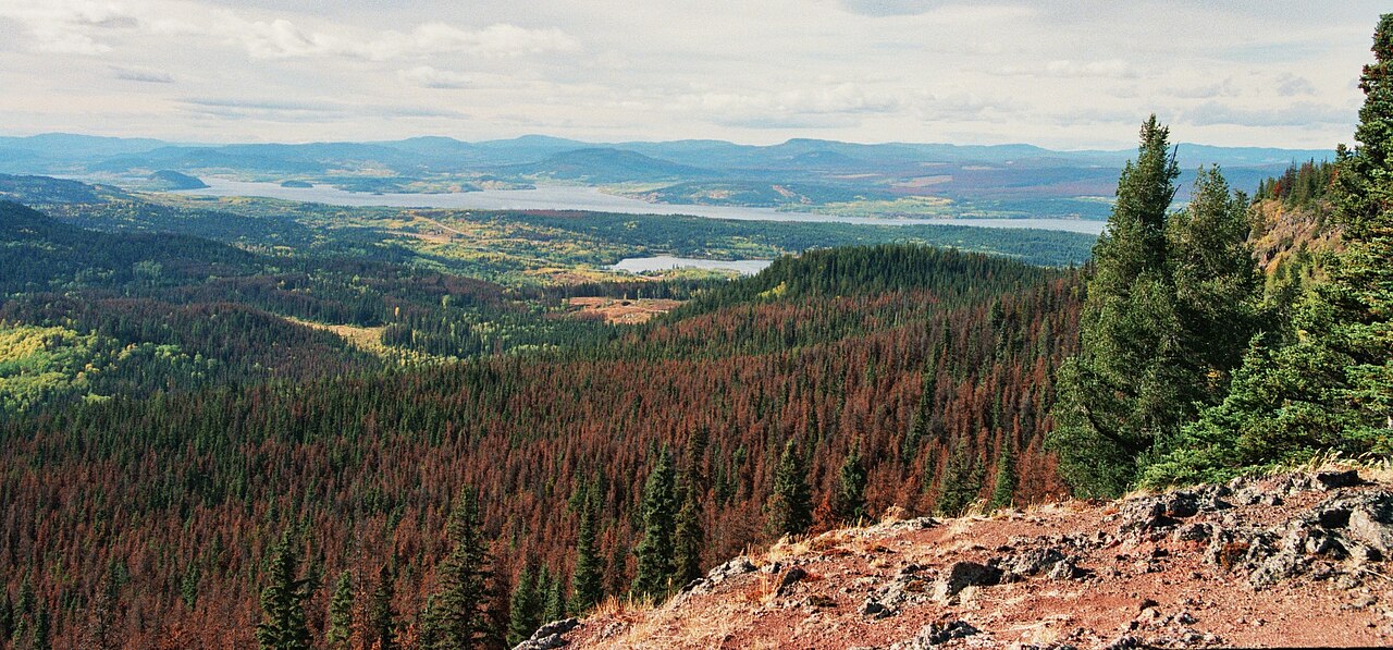
A steep forest climb reaches several viewpoints above Fraser Lake and the former fire-lookout site. The old tower is no longer a reliable landmark or attraction: a later source reports it destroyed in a 2022 windstorm.
Sources reviewed . This is a research date, not a trail inspection.
- Distance
- 8.2 kmRound trip
- Elevation gain
- Not establishedCumulative ascent for this outing has not been established.
- Walking time
- 4-6 hours
- Difficulty
- ModerateThere and Back
Map & elevation
Elevation profile
A full-route elevation profile is not available yet. The mapped paths have not been verified as one continuous outing.
Choose a specific route where available. Individual map fragments are not shown as separate hike stages.
Mapped named trail sections. Shows the named source trail. The full published outing, return journey and current on-the-ground alignment are not independently established by this line. Line source (opens original source).
Getting there & parking
From the Fraser Lake visitor centre, travel east on Highway 16 for about 14.6 km to the small access on the south side of the highway. The municipal guide warns that this turn is hard to see and lies on a bend. Use the designated trail parking area, which is described as holding around six vehicles, rather than stopping on the highway shoulder. Arriving from Prince George, identify the south-side entrance near Fraser Mountain Road carefully and turn only when safe.
Map position: 54.05490, -124.63254 · start point of published trip track (parking unverified). Embedded trip-map feature 'FraserMtDec2025': first recorded coordinate [-124.632536, 54.054898]. Point extracted from the original public trip map. A track start is evidence of where recording began, not certification of parking, legal access, road suitability or the complete route.
On the trail
The marked trail begins on the left side of the parking area and uses orange diamonds. Its first approximately 500 m climbs an old ski slope with grass underfoot. At roughly 1 km, a left-side viewpoint and bench overlook the eastern end of Fraser Lake and surrounding river country. After about 500 m of easier grade, the route steepens again toward another viewpoint near the 3 km mark, then traverses the mountain to a small road leading to the old lookout site. The municipal approach is about 4.1 km one way; longer club outings have different scope. Return by the orange-marked route. Do not expect the tower pictured in older guides, and treat the cave/cliff side trail as a separate extension.
Terrain: exposure.
Distance and elevation source notes
~13 km
460 m
Source comparison: Ramblers longer outing; 13 km; 460 m ascent; approximate; club there-and-back listing scope. A source edition, network range or unresolved start/endpoint is not a separate route.
Source comparison: Municipal lookout approach; 8.2 km; calculated return from 4.1 km one-way scope. This is another description of the main outing, a duplicate endpoint, an unscoped source claim, or a related facility.
Conditions & seasons
Season-specific access has not been established in this guide. Read the dated notices and original land-manager information before choosing a departure date.
These are dated research notes. Open the trip planner for current available weather and advisory feeds; no alert found does not establish that a trail or road is open.
Camping & overnight plans
On-route camping permission has not been established for this outing. Check the relevant land manager before planning an overnight stay; a mapped lake, cabin or previous tent location does not confirm permission.
Photos of Fraser Mountain
Original photo galleries
These galleries stay on their photographers’ original websites.
- Fraser Mountain May 10, 2026 (opens original source) · Caledonia Ramblers
- Fraser Mountain June 23, 2024 (opens original source) · Caledonia Ramblers
- Fraser Mountain February 11, 2024 (opens original source) · Caledonia Ramblers
- Fraser Mountain February 12, 2023 (opens original source) · Caledonia Ramblers
- Fraser Mountain June 19, 2022 (opens original source) · Caledonia Ramblers
- Fraser Mountain January 23, 2022 (opens original source) · Caledonia Ramblers
- Fraser Mountain September 26, 2021 (opens original source) · Caledonia Ramblers
- Fraser Mountain September 15, 2018 (opens original source) · Caledonia Ramblers
- Fraser Mountain May 22, 2016 (opens original source) · Caledonia Ramblers
- Fraser Mt in Fraser Lake, BC — photographs and trip report (opens original source) · Hiking Prince George
Take this guide with you
Choose a trip pack or an available individual sheet for your map case.
Sources, dates & research notes
Descriptions are written for this guide from the linked evidence. Source review dates, published reports and field observations can differ. Photographs and route lines retain their own attribution and reuse terms.
- https://caledoniaramblers.ca/trails/fraser-mountain (opens original source)
- https://hiking.princegeorge.tech/hiking-prince-george-west/ (opens original source)
- https://www.fraserlake.ca/sites/26/files/2024-08/Fraser_Lake_Hiking_TrailsV2.pdf (opens original source)
- https://delivery.maps.gov.bc.ca/arcgis/rest/services/mpcm/bcgwpub/MapServer/280 (opens original source)
- https://hiking.princegeorge.tech/fraser-lake/ (opens original source)
OpenStreetMap line references (3)
These contributor-mapped features support the map geometry. They are separate from the written access and route sources.
Details still being researched
- gainM
- dogs
- accessibility
- camping
- seasonal
Nearby and related guides
- Camping · Vanderhoof & Fraser Lake
Beaumont campground
A Fraser Lake camping and beach stop beside Highway 16, with a short interpretive walk through local natural and historical features. It is separate from the mountain hikes around…
Camping destination · access & overnight informationRead guide → - Hikes · Vanderhoof & Fraser Lake
Ormond Lake Trail
A historical lake route affected by the 2018 Shovel Lake Fire. The municipal guide lists it as indefinitely closed; it should remain a planning reference until reopening and safe…
Read the access and route notesRead guide → - Waterfalls · Vanderhoof & Fraser Lake
Cabin Creek Falls
A short, mostly level forest walk reaches the upper view of a small waterfall off Holy Cross FSR. The easy approach ends beside slippery rock, and the lower falls are not a safe…
1 km round tripRead guide → - Hikes · Vanderhoof & Fraser Lake
Black Point Trail
A historical forest trail descends to Francois Lake and continues along shore to Black Point. The municipal brochure still carries an indefinite closure after the 2018 fires, so…
3 km round tripRead guide → - Camping · Vanderhoof & Fraser Lake
Greer Creek recreation site
A small four-site camping area on the Nechako River below the mouth of Greer Creek. This river campsite is separate from the Greer Creek Falls hiking trailhead on Kluskus FSR.
Camping destination · access & overnight informationRead guide → - Waterfalls · Vanderhoof & Fraser Lake
Greer Creek Falls
A short forest approach ends beside an approximately 8 m waterfall southeast of Vanderhoof. The final descent is steeper than the easy woodland start, and the different published…
Easy / 3 km round trip / 95 m gainRead guide →