Mount Pope / Nak'al
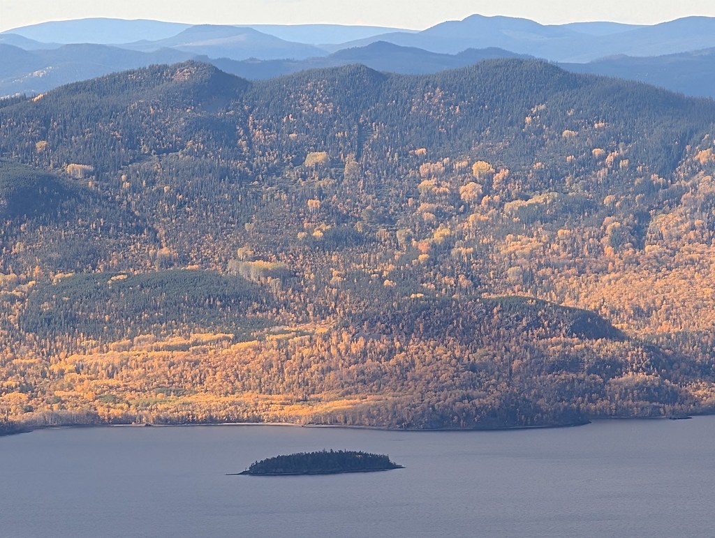
A sustained mountain trail above Fort St. James reaches a summit gazebo overlooking Stuart Lake and the ranges to the north. The park is day use only, with no drinking-water supply on the route.
Sources reviewed . This is a research date, not a trail inspection.
- Distance
- 13 kmRound trip
- Elevation gain
- Not establishedThe source lists 790 m with the destination approach. The stored distance includes a calculated return, but climbing on that return has not been separately established.
- Walking time
- 4-6 hours
- Difficulty
- ModerateThere and Back
Map & elevation
Elevation profile
Full round trip · approximately 12.5 km mapped
Approximate terrain elevation. Mapped distance may differ from the published hike distance.
Map and elevation sources
Approximate ground elevation from a 90 m terrain model. Distance follows the mapped itinerary and may differ from published walking distance. This is a terrain-model profile, not a surveyed measurement. Any ascent total is identified separately with its own source or estimation method.
The main source component begins15m from the published trip start and ends2m from the mapped summit shelter and10m from the independently named Mount Pope peak. BC Parks describes the summit gazebo as the objective and the same-trail descent. The detached36m viewpoint spur is excluded because it is not part of the complete main approach.
Route source 1Route source 2Route source 3Route source 4Route source 5Route source 6Route source 7Copernicus GLO-90 terrain elevations via Open-Meteo (CC BY4.0); linework: Open Database License (ODbL) 1.0 · checked 2026-10-18 · CC BY4.0 elevation data; Open Database License (ODbL) 1.0 linework. Copernicus DEM 2021 GLO-90 via Open-Meteo. Linework source: https://www.openstreetmap.org/way/140536462. Sampled and rounded for display.
Complete mapped outing from Mount Pope trailhead, including the return on the same route. Line source (opens original source).
Getting there & parking
Travel through Fort St. James on Stuart Drive West.
Turn west onto Stones Bay Road and continue about 4 km to the signed hiking lot on the right.
Parking: Signed trailhead parking is on the right about 4 km along Stones Bay Road, northwest of Fort St. James.
Full access notes
Drive through Fort St. James on Stuart Drive West, then turn west onto Stones Bay Road. The signed trailhead parking area is on the right about 4 km along that road, approximately 7 km northwest of town. Use the hiking entrance rather than an informal access to the nearby climbing cliffs. Carry all required drinking water before leaving the parking area; BC Parks identifies no potable supply along the ascent.
Map position: 54.47016, -124.31526 · start point of published trip track (parking unverified). Embedded trip-map feature 'PopeMt': first recorded coordinate [-124.315257, 54.470159]. Point extracted from the original public trip map. A track start is evidence of where recording began, not certification of parking, legal access, road suitability or the complete route.
On the trail
Follow the designated summit hiking trail, keeping separate from the limestone climbing approaches.
Continue to the gazebo at the mountain summit, the normal turnaround.
Full route notes
Follow the designated summit trail through the limestone mountain’s forested slopes to the gazebo on top. The official description gives 6.5 km each way and approximately 790 m of gain, with four to six hours for the return outing. Keep the ascent line distinct from rock-climbing approaches and avoid shortcuts across vegetation or unstable rock. The summit shelter provides a place to stop and take in Stuart Lake and the surrounding mountains before descending the same way. Cultural and natural features, including any caves or rock markings, are protected and must be left undisturbed. Return with enough daylight for the full descent.
The way back
Descend the same hiking trail. BC Parks gives 6.5 km each way, about 790 m of gain and 4–6 hours for the return trip.
Distance and elevation source notes
7 km to summit
750 m
Conditions & seasons
BC Parks permits snowshoeing and skiing on the same general trails in winter, but there are no set ski tracks. A summer hiking description is not an assessment of current snow or ice.
Winter route
BC Parks describes winter skiing and snowshoeing on the same trails as summer, with no set ski tracks.
These are dated research notes. Open the trip planner for current available weather and advisory feeds; no alert found does not establish that a trail or road is open.
Camping & overnight plans
Overnight camping is prohibited in Mount Pope Park. The summit gazebo is a day-use shelter, not a booking or camping facility.
Photos of Mount Pope / Nak'al
Original photo galleries
These galleries stay on their photographers’ original websites.
- Pope Mountain February 23, 2025 (opens original source) · Caledonia Ramblers
- Pope Mountain September 15, 2024 (opens original source) · Caledonia Ramblers
- Pope Mountain February 25, 2024 (opens original source) · Caledonia Ramblers
- Mount Pope February 19, 2023 (opens original source) · Caledonia Ramblers
- Pope Mountain February 13, 2022 (opens original source) · Caledonia Ramblers
- Pope Mountain November 28, 2021 (opens original source) · Caledonia Ramblers
- Pope Mountain June 21, 2020 (opens original source) · Caledonia Ramblers
- Pope Mountain December 29, 2019 (opens original source) · Caledonia Ramblers
- Pope Mountain June 23, 2018 (opens original source) · Caledonia Ramblers
- Pope Mt in Fort St James, BC — photographs and trip report (opens original source) · Hiking Prince George
Take this guide with you
Choose a trip pack or an available individual sheet for your map case.
Sources, dates & research notes
Descriptions are written for this guide from the linked evidence. Source review dates, published reports and field observations can differ. Photographs and route lines retain their own attribution and reuse terms.
- https://bcparks.ca/mount-pope-park/ (opens original source)
- https://hiking.princegeorge.tech/pope-mt/ (opens original source)
- https://www.caledoniaramblers.ca/trails/pope-mountain (opens original source)
OpenStreetMap line references (4)
These contributor-mapped features support the map geometry. They are separate from the written access and route sources.
Details still being researched
- dogs
- accessibility
Nearby and related guides
- Camping · Fort St. James
Paarens Beach campground
A Stuart Lake campground with a broad beach and boat launch, convenient for exploring the Fort St. James area. Nearby mountain hikes require a separate drive and should not be…
Camping destination · access & overnight informationRead guide → - Hikes · Vanderhoof & Fort St. James
Murray Ridge trails (Fort St. James)
Newer trails explore the ridge west of Murray Ridge Ski Hill near Fort St. James. They offer ridge views, but the published exploratory recording is not a dependable standardized…
ModerateRead guide → - Camping · Fort St. James
Sowchea Bay campground
A Stuart Lake campground west of Fort St. James, with many sites near the water. It is primarily a lake camping destination rather than a documented long hiking route.
Camping destination · access & overnight informationRead guide → - Waterfalls · Fort St. James
Tsilcoh Falls
A short forest approach north of Fort St. James reaches a waterfall, picnic area and pit toilets. The lengthy road approach should be planned separately from the short walking…
2.4 km round tripRead guide → - Hikes · Fort St. James
Shass Mountain
A mountain walk reached by paddling Grassham Lake first. The boat approach is an essential part of the outing, and the summit’s hiking distance does not include travel across the…
Hard / 12.4 km round trip / Not established gainRead guide →