1,740 mPublished route measurement 1,740 m (this is the decription of the original trail up the mountain, see description for link to the newer Teepee Creek route)
Walking time
10 hours
Difficulty
ExpertThere and Back
Map & elevation
Opening the map…
Partial elevation profile
Mapped portion · walking direction unconfirmed · 7.30 km
This chart covers only part of the route. It does not establish the full hike or a return journey.
Coverage and elevation sources
7.30 km along source section 1 of 1, in its mapped direction. Approximate 90 m terrain model along this mapped section. Separate sections are not joined. This chart does not measure total trail ascent or establish current access; use the guide’s published outing measurements.
AllTrails lists about 19.5 km return. The original lower-start route and newer Teepee Creek/Big Rock approach have different distances and terrain; this link does not establish that they share the same track.
Mapped named trail. This is the source-labelled old lower-start trail. It is distinct from the Teepee Creek approach and does not establish current lawful road access. Line source (opens original source).
Getting there & parking
The original lower Mount Terry Fox trailhead is near Stone Road and the railway crossing north of Valemount, below the newer Teepee Creek access. Historical instructions use the gravel-pit area beyond the designated rail crossing; confirm the signed, lawful access before entering industrial or private-road space. The local steward now distinguishes this minimally maintained lower route from the higher Teepee Creek parking, which has a different road approach and much less initial climbing.
Original approach crosses railway/private-access areas; lawful current vehicle access is unconfirmed.
Map position: 52.89700, -119.30877 · source-published trailhead / parking waypoint. Embedded trip-map feature 'Old Trailhead': point [-119.308766, 52.897001].
Named access waypoint extracted from the original public trip map. Current road/parking conditions and legal access still require checking.
Older trail access · 52.89700, -119.30877. Named point on source trip map; position and feature type retained as factual observations. Location source (opens original source)
Trail access · 52.90264, -119.28869. Named point on source trip map; position and feature type retained as factual observations. Location source (opens original source)
Newer trail access · 52.90235, -119.28955. Named point on source trip map; position and feature type retained as factual observations. Location source (opens original source)
Older trail access · 52.89686, -119.30879. Named point on source trip map; position and feature type retained as factual observations. Location source (opens original source)
On the trail
The historical lower trail climbs a series of 17 switchbacks to a forested ridge, then follows cairns and the established route toward a radio tower. From the tower, the summit is approximately 2 km east, while the Terry Fox monument is about 2.5 km north with a connection between them. The small alpine lake beyond the tower is the first reported water source. The club’s roughly 18 km and 1,740 m gain describe this original, lower-start route, not the newer Teepee Creek hike. Because the lower trail is now minimally maintained, expect more navigation and obstacles than on a routinely cleared path.
Terrain: very steep ascent · rough trail · alpine route.
Distance and elevation source notes
18 km
1,740 m (this is the decription of the original trail up the mountain, see description for link to the newer Teepee Creek route)
Source comparison: Teepee Creek–Mount Terry Fox; source does not state return basis scope. This is another description of the main outing, a duplicate endpoint, an unscoped source claim, or a related facility.
Source comparison: Original Terry Fox valley-bottom trail; source does not state return basis scope. This is another description of the main outing, a duplicate endpoint, an unscoped source claim, or a related facility.
Conditions & seasons
The upper mountain can retain snow in summer and the lower original approach is less maintained than the newer route. No current winter maintenance or ordinary winter vehicle access was verified for this starting point.
These are dated research notes. Open the trip planner for current available weather and advisory feeds; no alert found does not establish that a trail or road is open.
Mount Terry Fox Park is day-use only. Plan the part of the trip inside the park without an overnight camp; toilets at a lower trailhead or lake do not change the park’s rule.
Photos of Mount Terry Fox
A photograph with confirmed reuse permission has not yet been added to this guide.
Surrounding area and context
These photographs provide context; they do not establish the appearance of this selected route or facility.
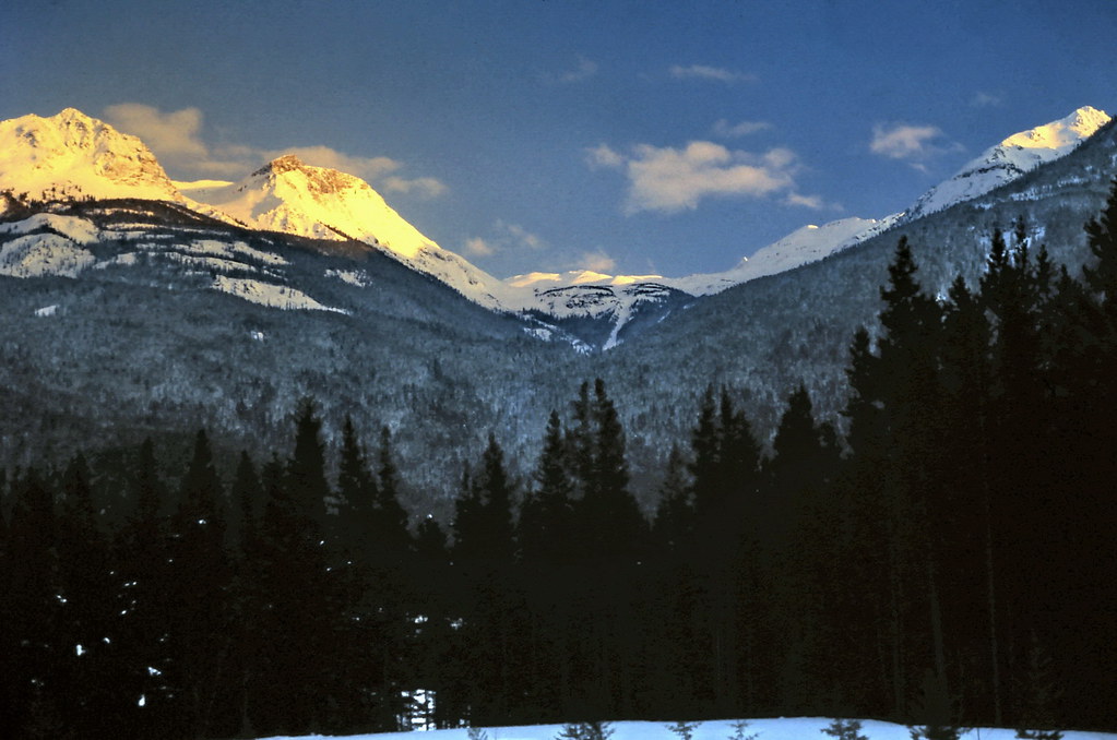
A historical winter view of Mount Terry Fox from a highway stop north of Valemount, photographed on 21 March 1982.gm_11215 Mount Terry Fox, BC 1982 (opens original source) · CanadaGood Gregory Melle · CC BY-NC-SA 2.0 (opens original source) · 1982-03-21. Downloaded provider display size; no local image edits. Display may crop the view. Adaptations retain the image licence. · Noncommercial only
Original photo galleries
These galleries stay on their photographers’ original websites.
Descriptions are written for this guide from the linked evidence. Source review dates, published reports and field observations can differ. Photographs and route lines retain their own attribution and reuse terms.