Mount Terry Fox — Teepee Creek lake
Start at the higher Teepee Creek trailhead and follow the creek valley uphill through forest, wet subalpine ground and a succession of small waterfalls. Continue to the alpine lake and return along the same creek trail. The local guide describes about 12 km return, 840 m of gain and five to six hours for this lake outing. The lake is a separate destination from the peak: turning toward Big Rock and climbing the mountain changes both distance and difficulty. Water can run just beneath the root mat in some forest sections, so expect wet footing even away from an obvious stream.
Sources reviewed . This is a research date, not a trail inspection.
- Distance
- 12 kmRound trip
- Elevation gain
- 840 mPublished route measurement
- Walking time
- 5–6 hours return
- Difficulty
- Not ratedOut and back
Map & elevation
Elevation profile
A full-route elevation profile is not available yet. The mapped paths have not been verified as one continuous outing.
Choose a specific route where available. Individual map fragments are not shown as separate hike stages.
Mapped named trail sections. Named creek and lake sections are shown. The source has a gap before the upper lake spur; that gap is retained, not filled with an invented connector. Line source (opens original source).
Getting there & parking
From Valemount, drive north on Highway 5 past the railway overpass and turn right onto Stone Road/Tinsley Pit Road, almost opposite the Terry Fox rest stop. Cross the railway only at the designated crossing, follow the posted access signs, and keep left toward Tinsley Pit Road. The signed approach includes a sharp left turn before continuing several kilometres uphill to the newer Teepee Creek parking lot. The local guide recommends a high-clearance four-wheel-drive vehicle and provides an access-road map because ordinary road maps may omit the final approach. The old Mount Terry Fox trail starts much lower, near the rail crossing, and is not the same trailhead.
Driving access has not been established for this selected route option; check its original sources.
Map position: 52.89700, -119.30877 · destination reference point. Embedded trip-map feature 'Old Trailhead': point [-119.308766, 52.897001]. Named access waypoint extracted from the original public trip map. Current road/parking conditions and legal access still require checking. This point is not a confirmed starting point for the selected route option.
On the trail
Start at the higher Teepee Creek trailhead and follow the creek valley uphill through forest, wet subalpine ground and a succession of small waterfalls. Continue to the alpine lake and return along the same creek trail. The local guide describes about 12 km return, 840 m of gain and five to six hours for this lake outing. The lake is a separate destination from the peak: turning toward Big Rock and climbing the mountain changes both distance and difficulty. Water can run just beneath the root mat in some forest sections, so expect wet footing even away from an obvious stream.
Conditions & seasons
The local guide lists the lake for May through September, subject to actual snow conditions. Higher terrain can remain snowy well into summer; the peak route is a summer objective and is not a documented winter variation.
These are dated research notes. Open the trip planner for current available weather and advisory feeds; no alert found does not establish that a trail or road is open.
Camping & overnight plans
The local guide identifies outhouses at the parking area and lake, but it does not establish a bookable campsite or unrestricted overnight permission there. Confirm the park’s current camping rules before turning this day hike into an overnight trip.
Photos of Mount Terry Fox — Teepee Creek lake
A photograph with confirmed reuse permission has not yet been added to this guide.
Surrounding area and context
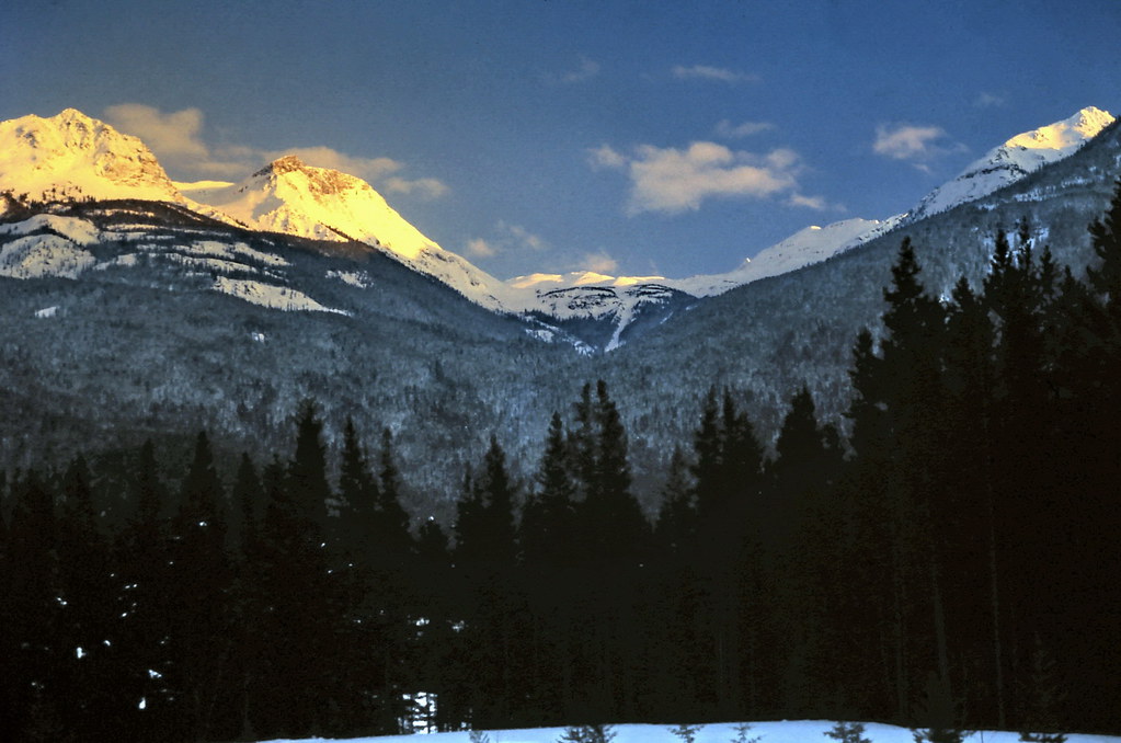
These photographs provide context; they do not establish the appearance of this selected route or facility.
Original photo galleries
These galleries stay on their photographers’ original websites.
- Mount Terry Fox August 20, 2022 (opens original source) · Caledonia Ramblers
- Terry Fox Mountain in Valemount BC — photographs and trip report (opens original source) · Hiking Prince George
- Mount Terry Fox — visitor photographs (opens original source) · AllTrails
Take this guide with you
Choose a trip pack or an available individual sheet for your map case.
Sources, dates & research notes
Descriptions are written for this guide from the linked evidence. Source review dates, published reports and field observations can differ. Photographs and route lines retain their own attribution and reuse terms.
- https://hikevalemount.com/teepee-creek-to-mt-terry-fox/ (opens original source)
- https://routing.openstreetmap.de/about.html (opens original source)
Details still being researched
- Current access and junction confirmation for the original lower trailhead remain unverified.
Nearby and related guides
- Hikes · Valemount & Mount Robson
Big Rock / Lower Teepee Lake loop
Teepee drainage routes split toward lake and Big Rock/summit.
Hard / 13 km round trip / 950 m gainRead guide → - Hikes · Valemount & Mount Robson
Teepee Creek lake
Teepee drainage routes split toward lake and Big Rock/summit.
Hard / 12 km round trip / 840 m gainRead guide → - Hikes · Valemount & Mount Robson
Terry Fox peak via Big Rock
Teepee drainage routes split toward lake and Big Rock/summit.
Hard / 16.5 km round trip / 1,450 m gainRead guide → - Hikes · Valemount & Mount Robson
Swift Mountain summit
Fireguard approach becomes flagged steep summit route.
Hard / 12.1 km round trip / 800 m gainRead guide → - Hikes · Valemount & Mount Robson
Jackman Flats Big Dune Trail
Interconnected sandy pine-and-lichen trail network.
Moderate / 6.2 km loopRead guide → - Hikes · Valemount & Mount Robson
Jackman Flats Juniper Trail
Interconnected sandy pine-and-lichen trail network.
Moderate / 3.4 km loopRead guide →