Wilkins Regional Park
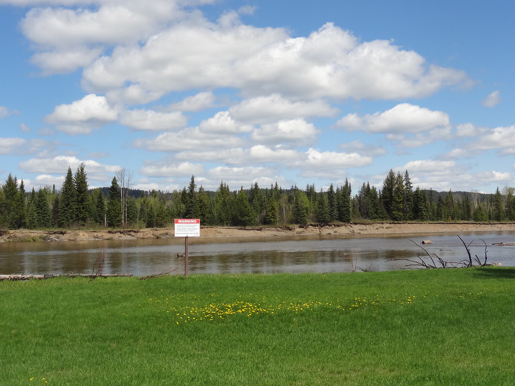
Gentle paths through large cottonwoods lead beside the Nechako River near Miworth. A picnic shelter and open field make it a useful short outing for mixed walking abilities.
Sources reviewed . This is a research date, not a trail inspection.
- Distance
- Not publishedTrip basis unconfirmed
- Elevation gain
- Not establishedCumulative ascent for this outing has not been established.
- Walking time
- Less than 3 hours
- Difficulty
- EasyLoop
Map & elevation
Elevation profile
A full-route elevation profile is not available yet. The mapped paths have not been verified as one continuous outing.
Choose a specific route where available. Individual map fragments are not shown as separate hike stages.
Mapped trail network. Shows three mapped footways within the Wilkins park area as a network. They do not select the complete published 3.5 km loop; source gaps and branches remain separate. Confirm the seasonal gate hours. Line source (opens original source).
Getting there & parking
From Prince George follow the Otway–Miworth road corridor west for about 15 km to Miworth. Turn right onto Wilkins Road and continue approximately 2 km to the park. The regional district lists a May 1–November 1 operating season, with a 9 am opening and closing times that vary by month; check the gate before starting a late walk.
Estimated drive from Prince George: 41 min · 20.5 km. Modeled one-way driving time from downtown Prince George using mapped road speeds, rounded up to a whole minute. No live traffic or invented forest-road multiplier. Regional District lists seasonal opening May 1–November 1 and month-specific gate hours. Check the gate schedule before relying on access.
Map position: 53.94996, -122.94570 · park location pin linked by regional district. Official RDFFG Map link resolves to place pin !3d53.9499583!4d-122.9456996; the map viewport coordinates were not used. Published park pin; exact trailhead parking position is not independently verified.
On the trail
Choose a short loop through the cottonwoods and along the river, using the marked park paths to return toward the picnic area. Published outing length is around 3.5 km, with gentle slopes rather than a sustained climb. Look for seasonal river and wildlife views without approaching unstable banks. The park contains a picnic shelter with a wood stove, open-field tables, a boat launch and toilets. Those facilities make a picnic stop convenient, but they do not establish permission for overnight camping. Check any fire restriction before using a stove or fire pit.
Distance and elevation source notes
3.5 km
Gentle slopes
Conditions & seasons
May 1–November 1; May 09:00–21:00, June/July 09:00–22:00, August/September 09:00–21:00, October 09:00–20:00.
These are dated research notes. Open the trip planner for current available weather and advisory feeds; no alert found does not establish that a trail or road is open.
Camping & overnight plans
On-route camping permission has not been established for this outing. Check the relevant land manager before planning an overnight stay; a mapped lake, cabin or previous tent location does not confirm permission.
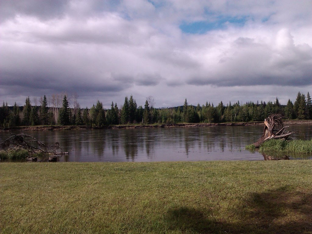
Photos of Wilkins Regional Park
Original photo galleries
These galleries stay on their photographers’ original websites.
- Wilkins Park February 2, 2020 (opens original source) · Caledonia Ramblers
Take this guide with you
Choose a trip pack or an available individual sheet for your map case.
Sources, dates & research notes
Descriptions are written for this guide from the linked evidence. Source review dates, published reports and field observations can differ. Photographs and route lines retain their own attribution and reuse terms.
- https://www.rdffg.ca/in-your-community/parks/wilkins-regional-park (opens original source)
- https://maps.app.goo.gl/GDxDNZTRa1JTaztD7 (opens original source)
- https://caledoniaramblers.ca/trails/wilkins-park (opens original source)
- https://project-osrm.org/ (opens original source)
- https://www.openstreetmap.org/copyright (opens original source)
OpenStreetMap line references (4)
These contributor-mapped features support the map geometry. They are separate from the written access and route sources.
Details still being researched
- gainM
- distanceKm
- dogs
- accessibility
- camping
Nearby and related guides
 Photo: Andrew Kurjata · CC BY-NC-SA 2.0 · Noncommercial onlyWalks · Prince George
Cranbrook Hill Greenway
A long wooded corridor connecting the UNBC side of Cranbrook Hill with Otway, with access to Forests for the World along the way. It supports short return walks as well as a much…
23 km of trails · Choose your walking routeRead guide →- Walks · Prince George
Greenway Trails
A long multi-use corridor follows Cranbrook Hill along Prince George’s western side. It links Otway, the UNBC access and southern connections, with forested hills and several…
Moderate / 17 km point to point / 235 m gainRead guide → - Parks · Prince George
Otway Trails — Caledonia Nordic
Forest trails within Prince George for summer walks and winter snowshoeing, with a separate ski network and a recently opened paved recreation circuit. Choose trails for the…
Read the access and route notesRead guide → - Walks · Prince George
Pidherny Recreation Site
A large volunteer-maintained network northwest of downtown supports hiking, running and mountain biking. Many trails include technical bike features, so a walking route needs…
Club outing range 5–15 km; broader network approximately 30 kmRead guide → - Hikes · Prince George
Pilot Mountain–Nechako Ridge
An exploratory point-to-point link joins the Pilot Mountain neighbourhood with the Pidherny network and Nechako Ridge lookout. It is longer and less settled than the short Pilot…
Moderate / 7 km · one way onlyRead guide → - Hikes · Prince George
Garvin’s Canyon
A local forest outing from the Pilot Mountain neighbourhood, described for hiking and snowshoeing. The available trip report provides a start and recorded distance but very little…
Moderate / 4.39 km · trip basis unconfirmed / Not established gainRead guide →