A large volunteer-maintained network northwest of downtown supports hiking, running and mountain biking. Many trails include technical bike features, so a walking route needs deliberate selection and awareness of other users.
Sources reviewed . This is a research date, not a trail inspection.
Club outing range 5–15 km; broader network approximately 30 kmTrip basis unconfirmed
Elevation gain
Not establishedCumulative ascent for this outing has not been established.
Walking time
4-6 hours
Difficulty
Not ratedLoop
Map & elevation
Opening the map…
Elevation profile
A full-route elevation profile is not available yet. The mapped paths have not been verified as one continuous outing.
Choose a specific route where available. Individual map fragments are not shown as separate hike stages.
More maps & trail files
AllTrails map
Ridge Trail Lookout loop on AllTrails
The hosted map shows a roughly 6.5 km lookout circuit that returns along North Nechako Road. It is not entirely within forest trails; confirm the intended road section and local access signs before starting.
Mapped trail network. Only Northern Lights, Remember Ed, Sally House Coat and Lazy Susan are shown. This is a partial selection from a much larger mixed-use trail network; connecting routes and bike-only trails are not inferred. Line source (opens original source).
Getting there & parking
Choose between the upper parking lot on Foothills Boulevard and the lower lot on Pidherny Road. The cycling club identifies both as official access points and asks visitors to use designated lots. Starting at the upper rather than lower entrance changes the climbing and return journey. Obtain the current trail map from the steward’s linked map service or a local bike shop before choosing a loop.
Map position: 53.98556, -122.86450 · recreation project location. Source-published recreation project point; not verified parking or trailhead.
On the trail
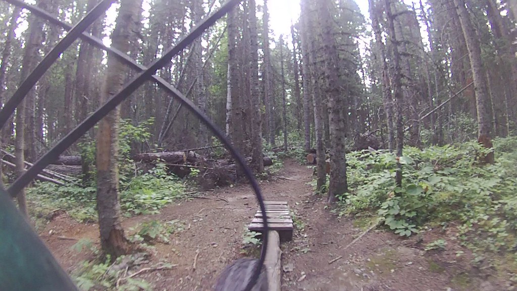
Use the entrance map to select connected trails suited to walking and to your fitness. Pidherny contains many separate paths with varying grades and constructed technical features; the broad 5–15 km outing range is not one marked hiking circuit. Watch for fast-moving riders, especially near jumps, blind corners and descending lines, and avoid standing on a feature or landing area. Return through a planned connection to the same parking lot unless you have arranged transport. The site is managed for non-motorized recreation, and its maintenance changes as volunteers build and repair trails. Pack out all waste and keep pets under control.
Distance and elevation source notes
5-15 km
60 m
Conditions & seasons
User-maintained site. Mountain-bike difficulty grades must not be presented as hiking difficulty.
These are dated research notes. Open the trip planner for current available weather and advisory feeds; no alert found does not establish that a trail or road is open.
On-route camping permission has not been established for this outing. Check the relevant land manager before planning an overnight stay; a mapped lake, cabin or previous tent location does not confirm permission.
Photos of Pidherny Recreation Site
A bicycle-camera view of a wooded trail and wooden riding feature at Pidherny, 12 August 2012. Bicycle equipment is visible in the foreground; no person is pictured. This historical cycling scene does not establish which paths are appropriate for walking today.FILE0299 (opens original source) · Outlander 650 · CC BY-NC 2.0 (opens original source) · 2012-08-12. Source display image downloaded without content edits; page presentation may resize. No people removed or imagery generated. · Noncommercial only; obtain commercial permission or replace before commercial use.
Original photo galleries
These galleries stay on their photographers’ original websites.
Descriptions are written for this guide from the linked evidence. Source review dates, published reports and field observations can differ. Photographs and route lines retain their own attribution and reuse terms.