Skip to guide
northward.NORTHERN BRITISH COLUMBIA
Hikes · Valemount & Mount Robson · Mount Robson

Berg Lake Trail / Robson Pass — Berg Lake

Start from the end of Kinney Lake Road and follow the main corridor through Kinney Lake, Whitehorn and the Valley of a Thousand Falls. After the sustained climb past the Emperor Falls junction, continue by the upper camps and uneven rebuilt sections to Berg Lake. Turn around or use the booked Berg Lake campsite as planned; Rearguard, Robson Pass and the alpine side trips are additional destinations beyond this lakeshore outing. Use the current signed stage distances because older maps predate the rebuilt trail.

Sources reviewed . This is a research date, not a trail inspection.

The locations GPX contains sourced points with their recorded roles. It contains no trail track or connecting route.

Distance
Not publishedTrip basis unconfirmed
Elevation gain
Not establishedCumulative ascent for this outing has not been established.
Walking time
Not published
Difficulty
Not rated
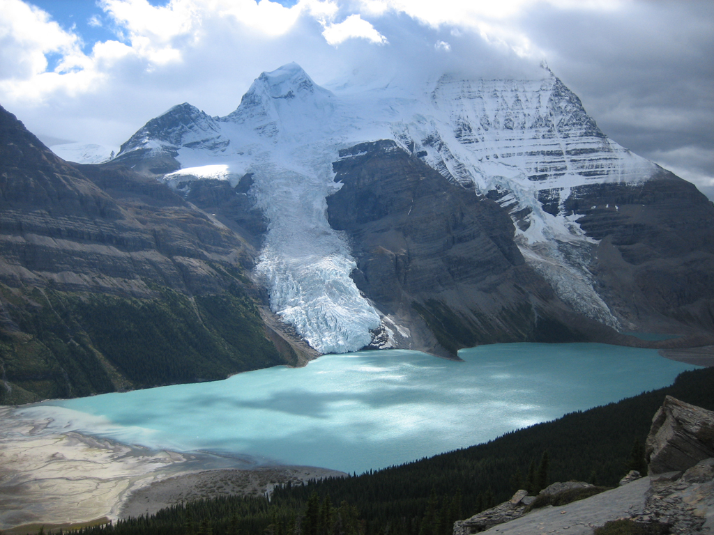
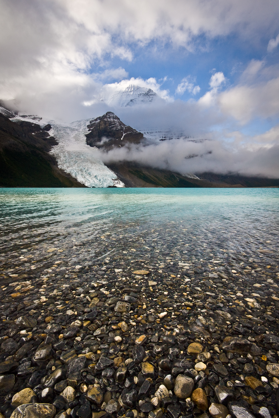
Mount Robson above Berg Lake
Mount Robson above Berg Lake.Berg Lake - Mount Robson.JPG (opens original source) · Airj1012 at English Wikipedia · CC BY 3.0 (opens original source) · 2005. Original image downloaded without editing; display may crop the view.

Map & elevation

Opening the map…

Elevation profile

A full-route elevation profile is not available yet.

A reusable trail line has not yet been verified for this outing. Any location pin shows the published location described above; it does not draw the hike or establish a navigable approach.

Getting there & parking

From Highway 16, turn into the signed Mount Robson park entrance near the Welcome Centre and follow Kinney Lake Road about 2.3 km to the road-end Berg Lake Trail parking. This is the vehicle access for the whole Berg Lake corridor. The waterfall and upper-basin destinations have no separate road approach.

Driving access has not been established for this selected route option; check its original sources.

Map position: 53.05085, -119.21441 · destination reference point. YORA-published shared Berg Lake trailhead This point is not a confirmed starting point for the selected route option.

On the trail

Start from the end of Kinney Lake Road and follow the main corridor through Kinney Lake, Whitehorn and the Valley of a Thousand Falls. After the sustained climb past the Emperor Falls junction, continue by the upper camps and uneven rebuilt sections to Berg Lake. Turn around or use the booked Berg Lake campsite as planned; Rearguard, Robson Pass and the alpine side trips are additional destinations beyond this lakeshore outing. Use the current signed stage distances because older maps predate the rebuilt trail.

Conditions & seasons

Season-specific access has not been established in this guide. Read the dated notices and original land-manager information before choosing a departure date.

Robson watercraft and wading equipment restriction

From May 4, 2026, BC Parks prohibits watercraft and wading equipment throughout Mount Robson Park waters to limit aquatic disease spread. This includes powered and unpowered craft, inflatables, wading clothing and boots. The hiking trails are not closed by this notice.

Source checked October 17, 2026 · BC Parks (opens original source)

These are dated research notes. Open the trip planner for current available weather and advisory feeds; no alert found does not establish that a trail or road is open.

Check weather & available updates →

Camping & overnight plans

On-route camping permission has not been established for this outing. Check the relevant land manager before planning an overnight stay; a mapped lake, cabin or previous tent location does not confirm permission.

Official reservation information (opens original source)

Photos of Berg Lake Trail / Robson Pass — Berg Lake

Mount Robson above Berg Lake
Mount Robson above Berg Lake.Berg Lake - Mount Robson.JPG (opens original source) · Airj1012 at English Wikipedia · CC BY 3.0 (opens original source) · 2005. Original image downloaded without editing; display may crop the view.
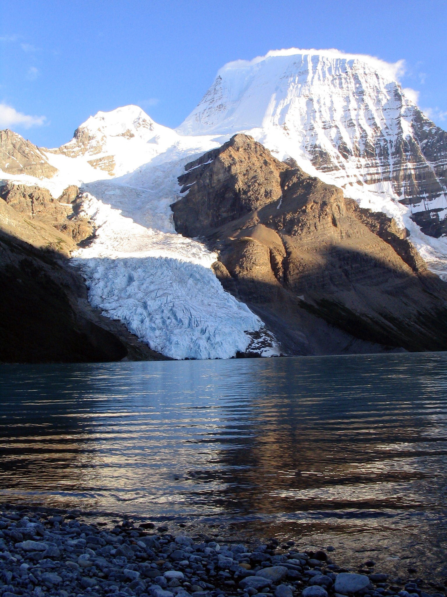
Berg Lake, Berg Glacier and Mount Robson
Berg Lake, Berg Glacier and Mount Robson.Berg Lake (1).jpg (opens original source) · Jeffrey Pang from Madison, NJ, USA · CC BY 2.0 (opens original source) · 2010-09-08 11:19. Original image downloaded without editing; display may crop the view.

Surrounding area and context

These photographs provide context; they do not establish the appearance of this selected route or facility.

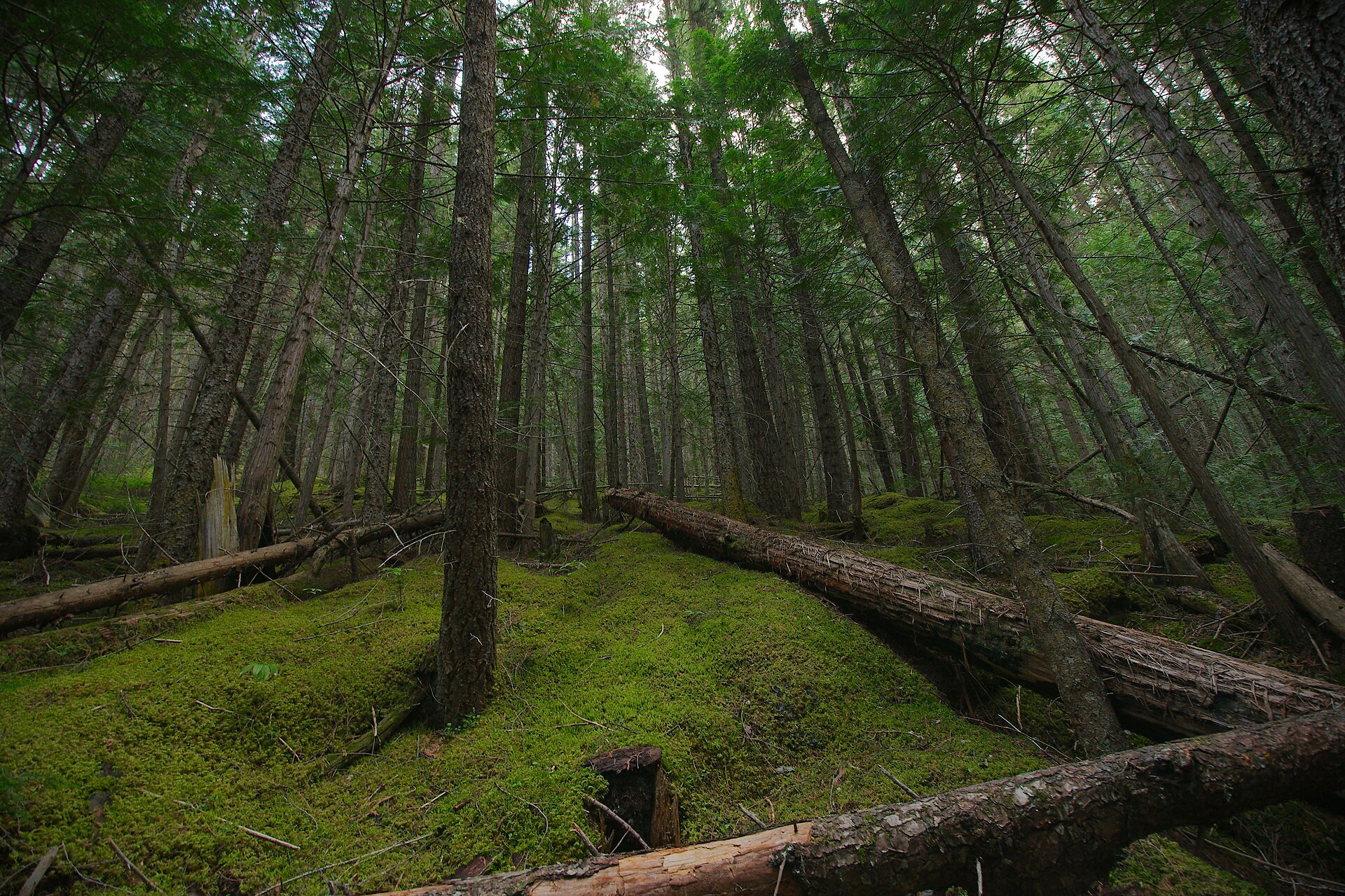
Forest along the Berg Lake Trail
Forest along the Berg Lake Trail.Forest along Berg Lake Trail.jpg (opens original source) · Sébastien Launay · CC BY 2.0 (opens original source) · 2011-08-19 19:18:22. Wikimedia thumbnail downloaded; Wikimedia resized the original. Display may crop the view.
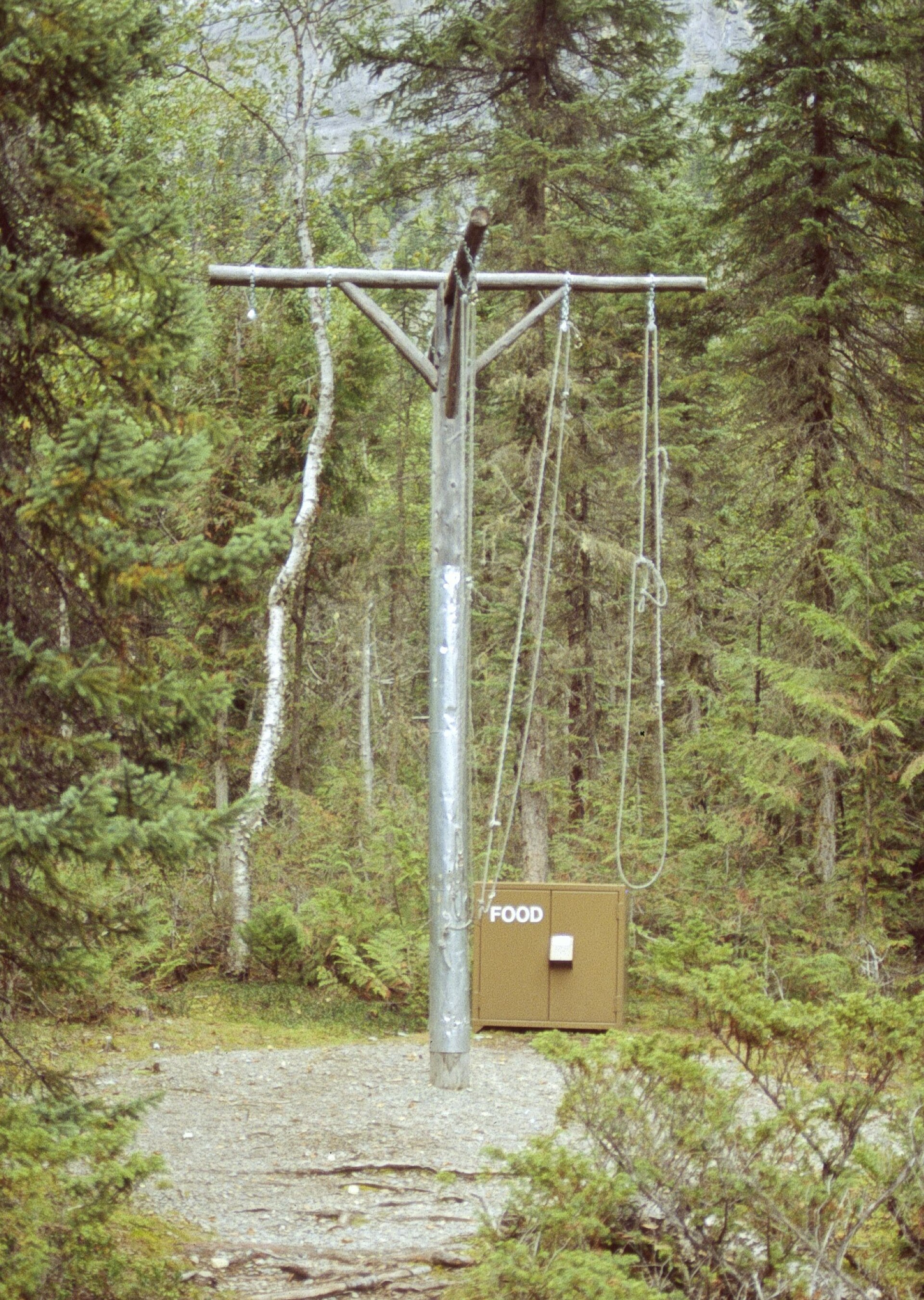
Food-storage pole
Food-storage pole photographed along the Berg Lake Trail.BearPole.jpg (opens original source) · Steffen Sledz (Zone42) · CC BY-SA 3.0 (opens original source) · 2005-09-15. Wikimedia thumbnail downloaded; Wikimedia resized the original. Display may crop the view. Any adapted CC BY-SA version retains that image license.

Original photo galleries

These galleries stay on their photographers’ original websites.

Take this guide with you

Choose a trip pack or an available individual sheet for your map case.

Sources, dates & research notes

Descriptions are written for this guide from the linked evidence. Source review dates, published reports and field observations can differ. Photographs and route lines retain their own attribution and reuse terms.
  1. https://hiking.princegeorge.tech/hiking-prince-george-east/ (opens original source)
  2. https://catalogue.data.gov.bc.ca/dataset/bc-geographical-names (opens original source)
  3. https://catalogue.data.gov.bc.ca/dataset/d92224ee-03ef-4904-be53-b677d8e01ac4/resource/69738aa8-2cc0-4975-aec6-4dc2e30990bf/download/bc-gazetteer-2026-08-12.csv (opens original source)
  4. https://bcparks.ca/mount-robson-park/berg-lake-trail/ (opens original source)
  5. https://offtracktravel.ca/berg-lake-trail-guide/ (opens original source)
Details still being researched
  • Current post-reconstruction reports give approximately 22 km while official general figures remain 23 km; exact route version and endpoint matter.

Nearby and related guides