First reach the Ozalenka cabin on the valley approach, then use the separate path heading south toward Ozalenka Lake. The club confirms this side-trip direction but does not provide a complete junction sequence or a verified additional distance. Obtain the current cabin-area route map before setting out. The Dore River bridge access notice also affects planning this longer visit.
Sources reviewed . This is a research date, not a trail inspection.
Check access before you leave
Dore River road access: closed bridge; reopening not verified
The provincial page updated October 8, 2026 still lists the Dore River Branch 1 bridge at kilometre 2.1 as closed with a zero-tonne load rating. The same page announced replacement work for the week of August 17 and expected two to three weeks of construction, but does not confirm reopening. These overlapping notices leave the current outcome unresolved. Confirm reopening with the road authority before relying on access beyond this bridge.
The locations GPX contains sourced points with their recorded roles. It contains no trail track or connecting route.
Site map
Opening the map…
A reusable trail line has not yet been verified for this outing. Any location pin shows the published location described above; it does not draw the hike or establish a navigable approach.
Getting there & parking
Access alert: the Dore River bridge at road kilometre 2.1 is listed as closed, and a reopening has not been verified. Confirm the road authority’s current status before using the approach below. Turn off Highway 16 at Lamming Pit Road about 201 km east of Prince George, then join Dore River Road after 2 km and turn right. At the slight fork around 6.3 km keep right; about 7.7 km farther on keep right at the next junction, then drive about 3.6 km to the trail parking on the right. Use the available protective vehicle fencing where provided because porcupines can damage vehicle components.
Map position: 53.25736, -120.40956 · source-published trailhead / parking area. PROJECT_NAME=Ozalenka trailhead and Parking Area; FOREST_FILE_ID=REC1473; official source point [-120.40956120027549, 53.25736043410624]
At the campsite
First reach the Ozalenka cabin on the valley approach, then use the separate path heading south toward Ozalenka Lake. The club confirms this side-trip direction but does not provide a complete junction sequence or a verified additional distance. Obtain the current cabin-area route map before setting out. The Dore River bridge access notice also affects planning this longer visit.
Conditions & seasons
Dore River Road is not maintained for winter vehicle access. Backcountry skiing/snowshoeing is possible; snowmobiles must remain outside the park at the Ozalenka trailhead.
These are dated research notes. Open the trip planner for current available weather and advisory feeds; no alert found does not establish that a trail or road is open.
Advance arrangements with Ozalenka Alpine Club are required; BC Parks lists 250-569-2596 for availability. Day visitors are asked to leave the cabin for overnight guests. Current capacity and fees have not been verified.
The Ozalenka campground is first come, first served. The cabin is a separate reserved accommodation managed by the Ozalenka Alpine Club. BC Parks also permits wilderness camping without facilities elsewhere inside West Twin Park. The unresolved Dore River bridge closure still affects access to this overnight trip.
Photos of Ozalenka Cabin — Ozalenka Lake
A photograph with confirmed reuse permission has not yet been added to this guide.
Surrounding area and context
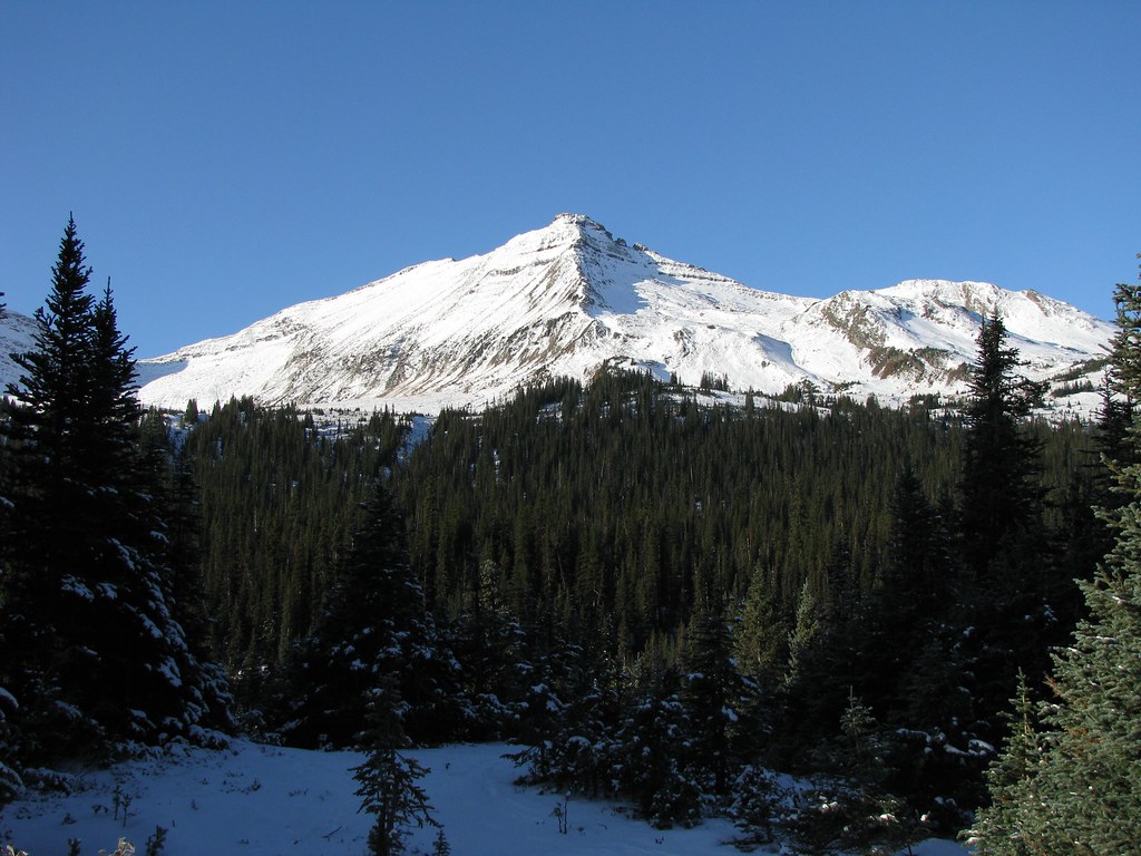
These photographs provide context; they do not establish the appearance of this selected route or facility.
The locally named Mittens peak across the valley from Ozalenka Cabin, 11 October 2009. This image shows the surrounding mountains rather than the cabin building.The Mittens (opens original source) · Dru! · CC BY-NC 2.0 (opens original source) · 2009-10-11. Downloaded provider display size; no local image edits. Display may crop the view. · Noncommercial only
Original photo galleries
These galleries stay on their photographers’ original websites.
Descriptions are written for this guide from the linked evidence. Source review dates, published reports and field observations can differ. Photographs and route lines retain their own attribution and reuse terms.