Not establishedThe source lists 1148 m with the destination approach. The stored distance includes a calculated return, but climbing on that return has not been separately established.
Walking time
6 - 8 hours
Difficulty
HardThere and Back
Map & elevation
Opening the map…
Partial elevation profile
From the documented starting point · 5.69 km
This chart covers only part of the route. It does not establish the full hike or a return journey.
Coverage and elevation sources
5.69 km of mapped source section, starting at Dunster Trail gravel-pit parking. This section alone does not establish the complete outing. Approximate 90 m terrain model along this mapped section. Separate sections are not joined. This chart does not measure total trail ascent or establish current access; use the guide’s published outing measurements.
Official recreation project linework; may contain multiple trail sections or historic alignments, not a verified complete hike. Government recreation-project geometry is an overview reference. It may contain branches or historic alignments; current access and a continuous navigable itinerary are not established. Line source (opens original source).
Getting there & parking
Leave Highway 16 on Dunster Station Road and continue across the Fraser River toward Raush Valley Road/Pepper Road. Turn right onto Pepper Road across the railway and continue to the gravel pit at the end. The community-forest steward warns of a false path along a sand ridge near the sign. The actual trail traverses about 40 m to the right at approximately signpost height, then climbs the back of the pit. An old switchback road gives a longer, gentler initial alternative and later rejoins the trail; use the current sign and steward map to distinguish it from the dead-end false path.
Estimated drive from Prince George: 3 hr 31 min · 243.8 km. Modeled one-way driving time from Prince George City Hall, using mapped road speeds. Forest-road sections can take substantially longer: surface, clearance, radio procedures, gates, washouts, plowing, and legal access are not verified by the router. No live traffic or invented forest-road multiplier is included. Allow extra time and check the dated access notes.
Map position: 53.11412, -119.83372 · source-published trailhead / parking waypoint. Embedded trip-map feature 'Trailhead parking': point [-119.833717, 53.114121].
Named access waypoint extracted from the original public trip map. Current road/parking conditions and legal access still require checking.
Trail access · 53.11412, -119.83372. Named point on source trip map; position and feature type retained as factual observations. Location source (opens original source)
On the trail
Climb to the valley lookout, approximately 2.3 km from the start in the club guide.
Continue roughly another 2 km into the alpine, where trail markers become sparse.
Follow the route into the Bob Lake basin toward the cabin on its west side. The ridge is a further objective about 600 m beyond the cabin area.
Full route notes
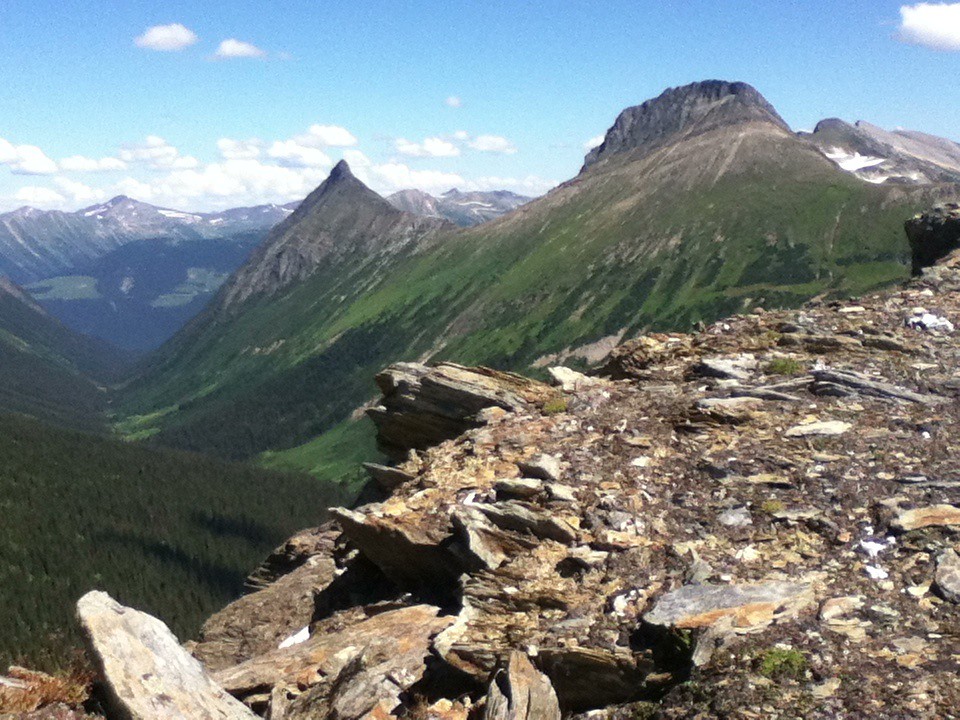
Climb steeply through forest toward the midway lookout, with a brief descent just beyond it before the ascent resumes. In the upper forest and alpine, follow the flagged route around the shoulder toward Bob Lake and Duchastel Hut, also known as Tom’s Cabin. The ridge beyond the lake opens a view into the Raush Valley. The steward suggests five to six hours return to the alpine and eight or more for the farther Raush viewpoint; the club’s approximately 6.8 km is one way to its ridge objective. An August 1, 2026 clearing report left three large trees near kilometres 1.5, 1.9 and 2.8. Select the alpine, lake or ridge turnaround explicitly and preserve enough time to descend the steep trail to the correct gravel-pit exit.
The way back
Choose the alpine, Bob Lake/cabin or farther ridge turnaround before starting. The club’s ridge distance is 6.8 km one way, or about 13.6 km if fully retraced.
Terrain: steep ascent · limited alpine marking.
Distance and elevation source notes
6.8 km to ridge
1148 m
Conditions & seasons
The upper approach becomes less marked after leaving the forest. Lingering snow or cloud can hide the basin route, and the long steep return needs enough daylight.
Clearing with three trees remaining
The maintenance party removed 14 fallen trees but left larger obstacles near trail kilometres 1.5,1.9 and 2.8. They also widened the trailhead clearing and partly brushed Pepper Pit Road.
These are dated research notes. Open the trip planner for current available weather and advisory feeds; no alert found does not establish that a trail or road is open.
Tom’s Cabin is beside Bob Lake. McBride Tourism directs visitors to check in with Dunster General Store about using it; do not assume an unreserved public bed. Confirm the current arrangement and carry a self-sufficient overnight plan if staying in the upper basin.
Photos of Dunster Trail
A photograph with confirmed reuse permission has not yet been added to this guide.
Original photo galleries
These galleries stay on their photographers’ original websites.
Descriptions are written for this guide from the linked evidence. Source review dates, published reports and field observations can differ. Photographs and route lines retain their own attribution and reuse terms.