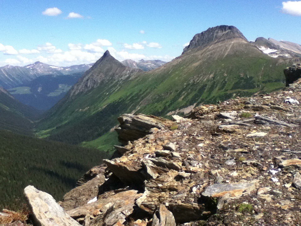
A shorter Dunster outing ending at Bob Lake before the farther ridge. From the gravel-pit trail entrance, climb past the valley viewpoint, continue through the upper forest and follow the established alpine approach to the lake. Reverse the same trail to return. The mapped itinerary measures approximately11.4km; that is a measurement of the source line, not the published13.6km ridge outing.
Sources reviewed . This is a research date, not a trail inspection.
Approx. 1,210 mTerrain-model estimate; not a surveyed measurement.
Walking time
Not published
Difficulty
HardOut and back
How the elevation gain was established
Outing: out-and-back outing from Dunster Trail gravel-pit parking to Bob Lake shore and back; 11.38 km along the mapped itinerary
Copernicus DEM 2021 GLO-90 via Open-Meteo (90 m resolution). v7-smoothed-ascent-1: interpolate retained terrain samples at 100 m spacing; apply one triangular 1:2:1 smoothing pass over ±100 m; preserve start, finish and documented turnaround heights; sum uphill excursions with a 5 m reversal threshold; round to nearest 10 m.
Approximate terrain-model ascent, not a field or GPS measurement. Coarse cells and smoothing can miss small climbs, switchbacks, structures and sharp terrain. Processing sensitivity is not a statistical confidence interval.
StartDunster Trail gravel-pit parking5.7 km · turn aroundBob Lake shore11.4 km · back at startDunster Trail gravel-pit parking
Approximate terrain elevation. Mapped distance may differ from the published hike distance.
Map and elevation sources
Approximate ground elevation from a 90 m terrain model. Distance follows the mapped itinerary and may differ from published walking distance. This is a terrain-model profile, not a surveyed measurement. Any ascent total is identified separately with its own source or estimation method.
The licensed BC recreation line is stored in descent order, from Bob Lake to the trailhead. Its last vertex is15m from the independently named Trailhead parking marker and its first vertex is13m from the independently identified Bob Lake shore observation. Reversing the source chain produces the described ascent, and retracing it produces the return. Tom’s Cabin and the farther ridge are separate detours not shown by this chain.
Leave Highway 16 on Dunster Station Road and continue across the Fraser River toward Raush Valley Road/Pepper Road. Turn right onto Pepper Road across the railway and continue to the gravel pit at the end. The community-forest steward warns of a false path along a sand ridge near the sign. The actual trail traverses about 40 m to the right at approximately signpost height, then climbs the back of the pit. An old switchback road gives a longer, gentler initial alternative and later rejoins the trail; use the current sign and steward map to distinguish it from the dead-end false path.
Estimated drive from Prince George: 3 hr 31 min · 243.8 km. Modeled one-way driving time from Prince George City Hall, using mapped road speeds. Forest-road sections can take substantially longer: surface, clearance, radio procedures, gates, washouts, plowing, and legal access are not verified by the router. No live traffic or invented forest-road multiplier is included. Allow extra time and check the dated access notes.
Map position: 53.11412, -119.83372 · source-published trailhead / parking waypoint. Embedded trip-map feature 'Trailhead parking': point [-119.833717, 53.114121].
Named access waypoint extracted from the original public trip map. Current road/parking conditions and legal access still require checking.
On the trail
Use the signed gravel-pit entrance described by the community-forest steward. Climb the steep forest path past the Dunster Valley viewpoint, continue through the upper forest and cross the alpine shoulder to Bob Lake. Stop at the lake shore for this option. Tom’s Cabin lies separately beyond the mapped lake endpoint, and the Raush Valley ridge is a longer extension. Return along the ascent route, taking care to leave the forest by the correct gravel-pit trail rather than the false sand-ridge path.
Terrain: steep ascent · limited alpine marking.
Distance and elevation source notes
Distance is calculated from the licensed government trail line and doubled for the retraced return. It is not the club’s farther-ridge distance.
Conditions & seasons
The upper approach becomes less marked after leaving the forest. Lingering snow or cloud can hide the basin route, and the long steep return needs enough daylight.
Clearing with three trees remaining
The maintenance party removed 14 fallen trees but left larger obstacles near trail kilometres 1.5,1.9 and 2.8. They also widened the trailhead clearing and partly brushed Pepper Pit Road.
These are dated research notes. Open the trip planner for current available weather and advisory feeds; no alert found does not establish that a trail or road is open.
Tom’s Cabin is beside Bob Lake. McBride Tourism directs visitors to check in with Dunster General Store about using it; do not assume an unreserved public bed. Confirm the current arrangement and carry a self-sufficient overnight plan if staying in the upper basin.
Photos of Dunster Trail — Bob Lake return
A photograph with confirmed reuse permission has not yet been added to this guide.
Original photo galleries
These galleries stay on their photographers’ original websites.
Descriptions are written for this guide from the linked evidence. Source review dates, published reports and field observations can differ. Photographs and route lines retain their own attribution and reuse terms.